Arabia
Check also Luigi
Mayer 'Ottoman Empire' Aquatints

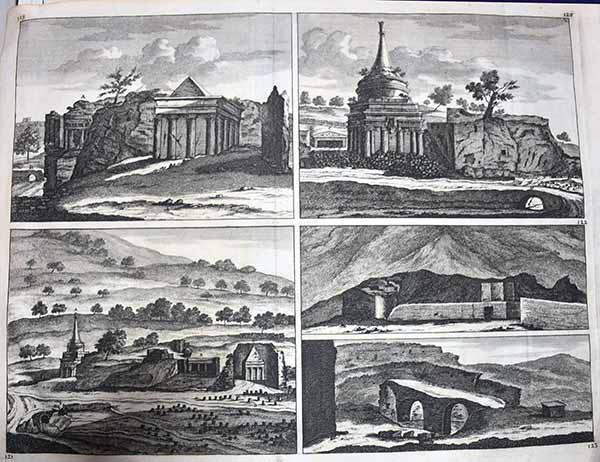
Jerusalem plate images 119/20/21/2223
. Copperplate engraving on a verge type hand laid paper, with watermark. Original folds. from: 'Voyage au Levant c'est a dire dans les principaux endroits de l'Asie Mineure dans les Isles de Chio, de Rhodes, de Chypre &c., de meme que dans les plus considerables villes d'Egypte, de Syrie, et de la Terre Sainteï, by Corneille le Brun (Cornelis de Bruyn), published by Henri de Kroonevelt, Delft, 1700. First edition in French, first published in Dutch in1698 ('Reizen.door de vermaardste Deelen van Klein Asia.') In 1702 an English edition appeared as well. Cornelis de Bruijn (also spelled Cornelius de Bruyn, pronounced (1652 1726/7) was a Dutch artist and traveler. He made two large tours and published illustrated books with his observations of people, buildings, plants and animals. Best known as a landscape artist, Le Bruyn travelled widely from a young age to Vienna, on to Rome then to Smyrna, Constantinople, Egypt, Jerusalem, Syria, Lebanon, and Turkey. Everywhere he went Le Bruyn depicted the scenes around him, he was especially interested in places of antiquity or historic interest, and his are the first images of the interior of a pyramid and Jerusalem to be widely available to Westerners. After an eight-year stay in Venice, Le Bruyn returned to The Hague in 1693 to publish this first book. From 1701 he started a second journey into Russia, Persia. Size . 47 x 37 cm. Image size is 37 x 28 cm. . His drawings of these ruins were a disappointment to his public as they differed from those they had already become familiar with. £95 inc delivery . These seem to be from the first edition but are all unlettered
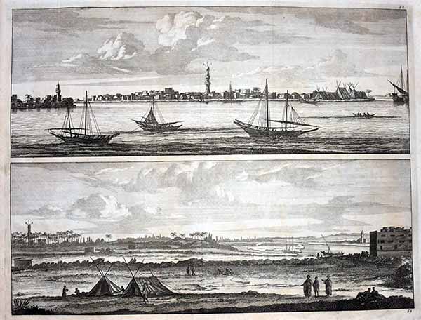
Plate 68 - 69 : 'Vilagio Primo att Nilo - Vista del Nilo presso di Damiate.' This plate shows panoramic views of the Nile, Egypt. Below near Damietta. Copperplate engraving on a verge type hand laid paper, with watermark. Original folds. from: 'Voyage au Levant c'est a dire dans les principaux endroits de l'Asie Mineure dans les Isles de Chio, de Rhodes, de Chypre &c., de meme que dans les plus considerables villes d'Egypte, de Syrie, et de la Terre Sainteï, by Corneille le Brun (Cornelis de Bruyn), published by Henri de Kroonevelt, Delft, 1700. First edition in French, first published in Dutch in1698 ('Reizen.door de vermaardste Deelen van Klein Asia.') In 1702 an English edition appeared as well. Cornelis de Bruijn (also spelled Cornelius de Bruyn, pronounced (1652 1726/7) was a Dutch artist and traveler. He made two large tours and published illustrated books with his observations of people, buildings, plants and animals. Best known as a landscape artist, Le Bruyn travelled widely from a young age to Vienna, on to Rome then to Smyrna, Constantinople, Egypt, Jerusalem, Syria, Lebanon, and Turkey. Everywhere he went Le Bruyn depicted the scenes around him, he was especially interested in places of antiquity or historic interest, and his are the first images of the interior of a pyramid and Jerusalem to be widely available to Westerners. After an eight-year stay in Venice, Le Bruyn returned to The Hague in 1693 to publish this first book. From 1701 he started a second journey into Russia, Persia. Size . 47 x 37 cm. Image size is 37 x 28 cm. . His drawings of these ruins were a disappointment to his public as they differed from those they had already become familiar with. £95 inc delivery . These seem to be from the first edition but are all unlettered

Plate 143 : Basilica / Church of the Holy Sepulchre Interior 1
Original folds. from: 'Voyage au Levant c'est a dire dans les principaux endroits de l'Asie Mineure dans les Isles de Chio, de Rhodes, de Chypre &c., de meme que dans les plus considerables villes d'Egypte, de Syrie, et de la Terre Sainteï, by Corneille le Brun (Cornelis de Bruyn), published by Henri de Kroonevelt, Delft, 1700. First edition in French, first published in Dutch in1698 ('Reizen.door de vermaardste Deelen van Klein Asia.') In 1702 an English edition appeared as well. Cornelis de Bruijn (also spelled Cornelius de Bruyn, pronounced (1652 1726/7) was a Dutch artist and traveler. He made two large tours and published illustrated books with his observations of people, buildings, plants and animals. Size . 47 x 37 cm. Image size is 37 x 28 cm. . His drawings of these ruins were a disappointment to his public as they differed from those they had already become familiar with. £95 inc delivery . These seem to be from the first edition but are all unlettered
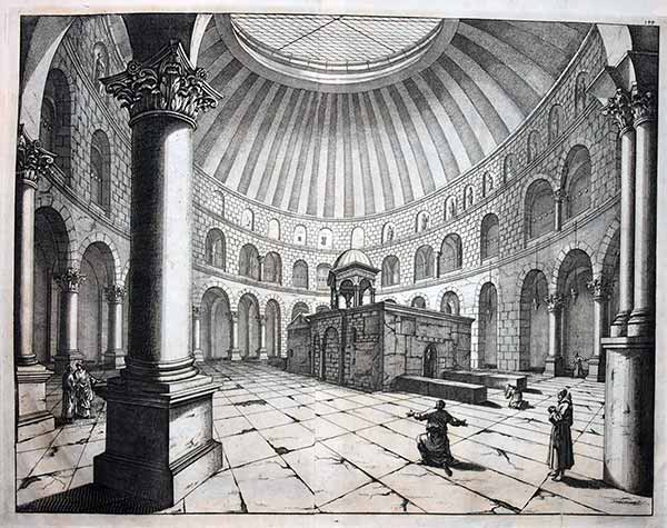
Plate 144 : Basilica / Church of the Holy Sepulchre Interior 2
Copperplate engraving on a verge type hand laid paper, with watermark. Original folds. from: 'Voyage au Levant c'est a dire dans les principaux endroits de l'Asie Mineure dans les Isles de Chio, de Rhodes, de Chypre &c., de meme que dans les plus considerables villes d'Egypte, de Syrie, et de la Terre Sainte', by Corneille le Brun (Cornelis de Bruyn), published by Henri de Kroonevelt, Delft, 1700. First edition in French, first published in Dutch in1698 ('Reizen.door de vermaardste Deelen van Klein Asia.') In 1702 an English edition appeared as well. Cornelis de Bruijn (also spelled Cornelius de Bruyn, pronounced (1652 1726/7) was a Dutch artist and traveler. He made two large tours and published illustrated books with his observations of people, buildings, plants and animals. Size . 47 x 37 cm. Image size is 37 x 28 cm. . His drawings of these ruins were a disappointment to his public as they differed from those they had already become familiar with. £95 inc delivery . These seem to be from the first edition but are all unlettered

Plate 145 : Basilica / Church of the Holy Sepulchre Exterior . Copperplate engraving on a verge type hand laid paper, with watermark. Original folds. from: 'Voyage au Levant c'est a dire dans les principaux endroits de l'Asie Mineure dans les Isles de Chio, de Rhodes, de Chypre &c., de meme que dans les plus considerables villes d'Egypte, de Syrie, et de la Terre Sainte', by Corneille le Brun (Cornelis de Bruyn), published by Henri de Kroonevelt, Delft, 1700. First edition in French, first published in Dutch in1698 ('Reizen.door de vermaardste Deelen van Klein Asia.') In 1702 an English edition appeared as well. Cornelis de Bruijn (also spelled Cornelius de Bruyn, pronounced (1652 1726/7) was a Dutch artist and traveler. He made two large tours and published illustrated books with his observations of people, buildings, plants and animals Size . 47 x 37 cm. Image size is 37 x 28 cm. . His drawings of these ruins were a disappointment to his public as they differed from those they had already become familiar with. £95 inc delivery . These seem to be from the first edition but are all unlettered ** if the set are wanted yell and will reduce the price**
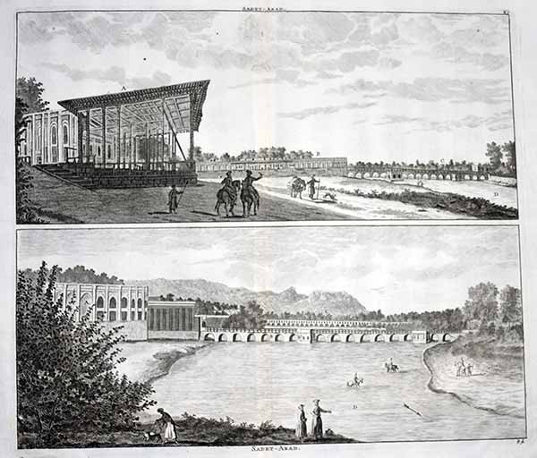
SADET ABAD-ROYAL GARDEN-TEHRAN-ZAYANDEH-IRAN This antique print, captioned 'Sadet-Abad', shows two images of Saadat Abad (now a burough of Tehran), then the royal gardens south of the city, on the Zayandeh river. Copperplate engraving on a verge type hand laid paper, with watermark. Original folds. from: 'Voyage au Levant c'est a dire dans les principaux endroits de l'Asie Mineure dans les Isles de Chio, de Rhodes, de Chypre &c., de meme que dans les plus considerables villes d'Egypte, de Syrie, et de la Terre Sainte', by Corneille le Brun (Cornelis de Bruyn), published by Henri de Kroonevelt, Delft, 1700. First edition in French, first published in Dutch in1698 ('Reizen.door de vermaardste Deelen van Klein Asia.') In 1702 an English edition appeared as well. Cornelis de Bruijn (also spelled Cornelius de Bruyn, pronounced (1652 1726/7) was a Dutch artist and traveler. He made two large tours and published illustrated books with his observations of people, buildings, plants and animals. Size . 47 x 37 cm. Image size is 37 x 28 cm. . His drawings of these ruins were a disappointment to his public as they differed from those they had already become familiar with. £85 inc delivery . These are from the 1702 English edition

Coraming, Kiesilosan, Sargabrand. Persia
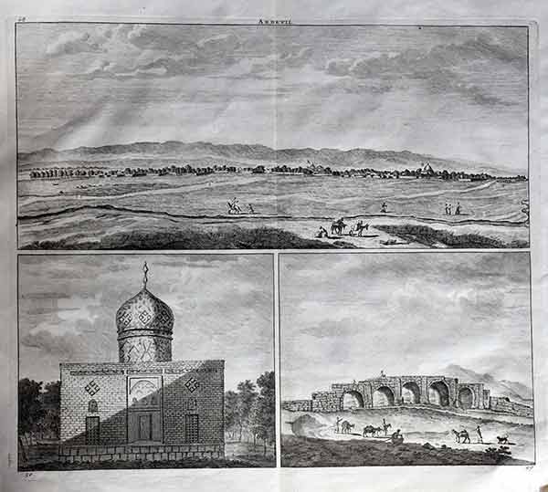
Caravane proche au village Coraming / Pont sur la rivier Kiesilosan / Village t' Sargabrand', shows three views, two of which unidentified villages in Iran, and a bridge over the Kiesilosan river. Copperplate engraving on a verge type hand laid paper, with watermark. Original folds. from: 'Voyage au Levant c'est a dire dans les principaux endroits de l'Asie Mineure dans les Isles de Chio, de Rhodes, de Chypre &c., de meme que dans les plus considerables villes d'Egypte, de Syrie, et de la Terre Sainte', by Corneille le Brun (Cornelis de Bruyn), published by Henri de Kroonevelt, Delft, 1700. First edition in French, first published in Dutch in1698 ('Reizen.door de vermaardste Deelen van Klein Asia.') In 1702 an English edition appeared as well. Cornelis de Bruijn (also spelled Cornelius de Bruyn, pronounced (1652 1726/7) was a Dutch artist and traveler. He made two large tours and published illustrated books with his observations of people, buildings, plants and animals. Size . 47 x 37 cm. Image size is 37 x 28 cm. . His drawings of these ruins were a disappointment to his public as they differed from those they had already become familiar with. £85 inc delivery . These are from the 1702 English edition

Ramla lamenting women Israel/ Judaica / Ramallah
Original folds. from: 'Voyage au Levant c'est a dire dans les principaux endroits de l'Asie Mineure dans les Isles de Chio, de Rhodes, de Chypre &c., de meme que dans les plus considerables villes d'Egypte, de Syrie, et de la Terre Sainteï, by Corneille le Brun (Cornelis de Bruyn), published by Henri de Kroonevelt, Delft, 1700. First edition in French, first published in Dutch in1698 ('Reizen.door de vermaardste Deelen van Klein Asia.') In 1702 an English edition appeared as well. Cornelis de Bruijn (also spelled Cornelius de Bruyn, pronounced (1652 1726/7) was a Dutch artist and traveler. He made two large tours and published illustrated books with his observations of people, buildings, plants and animals. Size . 47 x 37 cm. Image size is 37 x 28 cm. . His drawings of these ruins were a disappointment to his public as they differed from those they had already become familiar with. £85 inc delivery . These seem to be from the first edition but are all unlettered
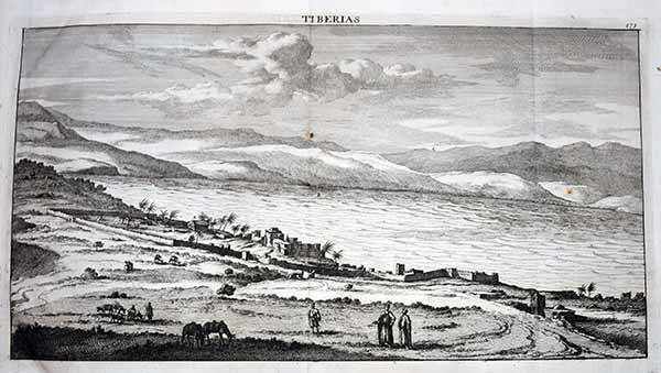
Tiberias
Caravane proche au village Coraming / Pont sur la rivier Kiesilosan / Village t' Sargabrand', shows three views, two of which unidentified villages in Iran, and a bridge over the Kiesilosan river. Copperplate engraving on a verge type hand laid paper, with watermark. Original folds. from: 'Voyage au Levant c'est a dire dans les principaux endroits de l'Asie Mineure dans les Isles de Chio, de Rhodes, de Chypre &c., de meme que dans les plus considerables villes d'Egypte, de Syrie, et de la Terre Sainte', by Corneille le Brun (Cornelis de Bruyn), published by Henri de Kroonevelt, Delft, 1700. First edition in French, first published in Dutch in1698 ('Reizen.door de vermaardste Deelen van Klein Asia.') In 1702 an English edition appeared as well. Cornelis de Bruijn (also spelled Cornelius de Bruyn, pronounced (1652 1726/7) was a Dutch artist and traveler. He made two large tours and published illustrated books with his observations of people, buildings, plants and animals. Size . 47 x 37 cm. Image size is 37 x 28 cm. . His drawings of these ruins were a disappointment to his public as they differed from those they had already become familiar with. £85 inc delivery . These are from the 1702 English edition

Joppe / Joppa / Jaffa
Caravane proche au village Coraming / Pont sur la rivier Kiesilosan / Village t' Sargabrand', shows three views, two of which unidentified villages in Iran, and a bridge over the Kiesilosan river. Copperplate engraving on a verge type hand laid paper, with watermark. Original folds. from: 'Voyage au Levant c'est a dire dans les principaux endroits de l'Asie Mineure dans les Isles de Chio, de Rhodes, de Chypre &c., de meme que dans les plus considerables villes d'Egypte, de Syrie, et de la Terre Sainte', by Corneille le Brun (Cornelis de Bruyn), published by Henri de Kroonevelt, Delft, 1700. First edition in French, first published in Dutch in1698 ('Reizen.door de vermaardste Deelen van Klein Asia.') In 1702 an English edition appeared as well. Cornelis de Bruijn (also spelled Cornelius de Bruyn, pronounced (1652 1726/7) was a Dutch artist and traveler. He made two large tours and published illustrated books with his observations of people, buildings, plants and animals. Size . 47 x 37 cm. Image size is 37 x 28 cm. . His drawings of these ruins were a disappointment to his public as they differed from those they had already become familiar with. £85 inc delivery . These are from the 1702 English edition

'Village Saksawa / Rochers Singuliers / Ruines de la Ville Cohm / Ruines des Murailles de la Ville', A view of an unidentified village, an oddly shaped rock formation, and two views of the ruins of Qom. Copperplate engraving on a verge type hand laid paper, with watermark. Original folds. from: 'Voyage au Levant c'est a dire dans les principaux endroits de l'Asie Mineure dans les Isles de Chio, de Rhodes, de Chypre &c., de meme que dans les plus considerables villes d'Egypte, de Syrie, et de la Terre Sainte', by Corneille le Brun (Cornelis de Bruyn), published by Henri de Kroonevelt, Delft, 1700. First edition in French, first published in Dutch in1698 ('Reizen.door de vermaardste Deelen van Klein Asia.') In 1702 an English edition appeared as well. Cornelis de Bruijn (also spelled Cornelius de Bruyn, pronounced (1652 1726/7) was a Dutch artist and traveler. He made two large tours and published illustrated books with his observations of people, buildings, plants and animals. Size . 47 x 37 cm. Image size is 37 x 28 cm. . His drawings of these ruins were a disappointment to his public as they differed from those they had already become familiar with. £85 inc delivery . These are from the 1702 English edition

De Brugh Allawerdie-Cham - De Chyaer-Baeg (The bridge Allah-Verdi Khan Pol (or Si-o-seh Pol) - Three views of Chahar Bagh.). It shows: The Bridge Allah-Verdi Khan Pol (or Si-o-she Pol = 33 arches bridge) in Isfahan, and three views of the Chahar Bagh (=Four Gardens), the 1650 meter long boulevard in Isfahan.m. Copperplate engraving on a verge type hand laid paper, with watermark. Original folds. from: 'Voyage au Levant c'est a dire dans les principaux endroits de l'Asie Mineure dans les Isles de Chio, de Rhodes, de Chypre &c., de meme que dans les plus considerables villes d'Egypte, de Syrie, et de la Terre Sainte', by Corneille le Brun (Cornelis de Bruyn), published by Henri de Kroonevelt, Delft, 1700. First edition in French, first published in Dutch in1698 ('Reizen.door de vermaardste Deelen van Klein Asia.') In 1702 an English edition appeared as well. Cornelis de Bruijn (also spelled Cornelius de Bruyn, pronounced (1652 1726/7) was a Dutch artist and traveler. He made two large tours and published illustrated books with his observations of people, buildings, plants and animals. Size . 47 x 37 cm. Image size is 37 x 28 cm. . His drawings of these ruins were a disappointment to his public as they differed from those they had already become familiar with. £85 inc delivery . These are from the 1700 English edition
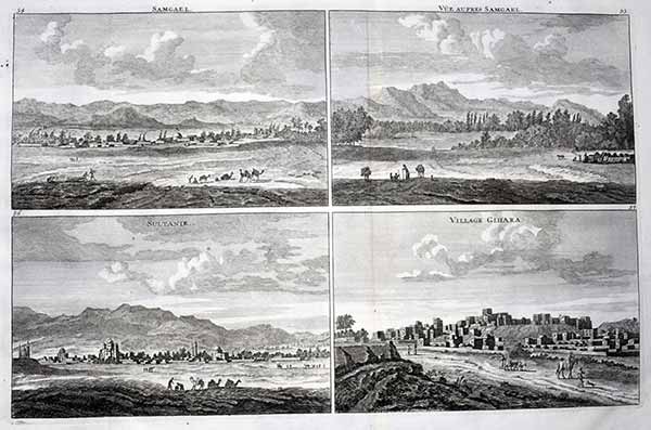
Samgael - - Sultanie - Gihara (View of Samgael - View near Samgael - Sultanie - Gihara village. It shows: Four views on one sheet, all of villages/towns with some people and camels beside the buildings. The village called Gihara is not traceable on modern maps.Copperplate engraving on a verge type hand laid paper, with watermark. Original folds. from: 'Voyage au Levant c'est a dire dans les principaux endroits de l'Asie Mineure dans les Isles de Chio, de Rhodes, de Chypre &c., de meme que dans les plus considerables villes d'Egypte, de Syrie, et de la Terre Sainte', by Corneille le Brun (Cornelis de Bruyn), published by Henri de Kroonevelt, Delft, 1700. First edition in French, first published in Dutch in1698 ('Reizen.door de vermaardste Deelen van Klein Asia.') In 1702 an English edition appeared as well. Cornelis de Bruijn (also spelled Cornelius de Bruyn, pronounced (1652 1726/7) was a Dutch artist and traveler. He made two large tours and published illustrated books with his observations of people, buildings, plants and animals. Size . 47 x 37 cm. Image size is 37 x 28 cm. . His drawings of these ruins were a disappointment to his public as they differed from those they had already become familiar with. £85 inc delivery . These are from the 1700 French edition

Homme Persan /Femme persan. . ~Persian Man + Woman It shows: Four views on one sheet, all of villages/towns with some people and camels beside the buildings. The village called Gihara is not traceable on modern maps.Copperplate engraving on a verge type hand laid paper, with watermark. Original folds. from: 'Voyage au Levant c'est a dire dans les principaux endroits de l'Asie Mineure dans les Isles de Chio, de Rhodes, de Chypre &c., de meme que dans les plus considerables villes d'Egypte, de Syrie, et de la Terre Sainte', by Corneille le Brun (Cornelis de Bruyn), published by Henri de Kroonevelt, Delft, 1700. First edition in French, first published in Dutch in1698 ('Reizen.door de vermaardste Deelen van Klein Asia.') In 1702 an English edition appeared as well. Cornelis de Bruijn (also spelled Cornelius de Bruyn, pronounced (1652 1726/7) was a Dutch artist and traveler. He made two large tours and published illustrated books with his observations of people, buildings, plants and animals. Size . 47 x 37 cm. Image size is 37 x 28 cm. . His drawings of these ruins were a disappointment to his public as they differed from those they had already become familiar with. £85 inc delivery . These are from the 1700 French edition
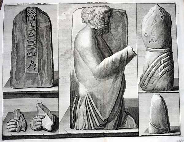
Pièce remplie de caractères - Pieces des figures Copperplate engraving on a verge type hand laid paper, with watermark. Original folds. from: 'Voyage au Levant c'est a dire dans les principaux endroits de l'Asie Mineure dans les Isles de Chio, de Rhodes, de Chypre &c., de meme que dans les plus considerables villes d'Egypte, de Syrie, et de la Terre Sainte', by Corneille le Brun (Cornelis de Bruyn), published by Henri de Kroonevelt, Delft, 1700. First edition in French, first published in Dutch in1698 ('Reizen.door de vermaardste Deelen van Klein Asia.') In 1702 an English edition appeared as well. Cornelis de Bruijn (also spelled Cornelius de Bruyn, pronounced (1652 1726/7) was a Dutch artist and traveler. He made two large tours and published illustrated books with his observations of people, buildings, plants and animals. Size . 47 x 37 cm. Image size is 37 x 28 cm. . His drawings of these ruins were a disappointment to his public as they differed from those they had already become familiar with. £45 inc delivery . These are from the 1700 French edition
Isle Neuve / Isle du Prince / Cote Meridionale de l'Arabie Heureuse / Baye de Musketta / Rivage ou Cote d'Arabie proche du cap de Monsandon / Isle de Lareke / Isle de Kimus" - Inseln islands iles Oman Iran Indonesia Indonesien Asia Copperplate engraving on a verge type hand laid paper, with watermark. Original folds. from: 'Voyage au Levant c'est a dire dans les principaux endroits de l'Asie Mineure dans les Isles de Chio, de Rhodes, de Chypre &c., de meme que dans les plus considerables villes d'Egypte, de Syrie, et de la Terre Sainte', by Corneille le Brun (Cornelis de Bruyn), published by Henri de Kroonevelt, Delft, 1700. First edition in French, first published in Dutch in1698 ('Reizen.door de vermaardste Deelen van Klein Asia.') In 1702 an English edition appeared as well. Cornelis de Bruijn (also spelled Cornelius de Bruyn, pronounced (1652 1726/7) was a Dutch artist and traveler. He made two large tours and published illustrated books with his observations of people, buildings, plants and animals. Size . 47 x 37 cm. Image size is 37 x 28 cm. . His drawings of these ruins were a disappointment to his public as they differed from those they had already become familiar with. £85 inc delivery . These are from the 1700 French edition
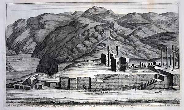

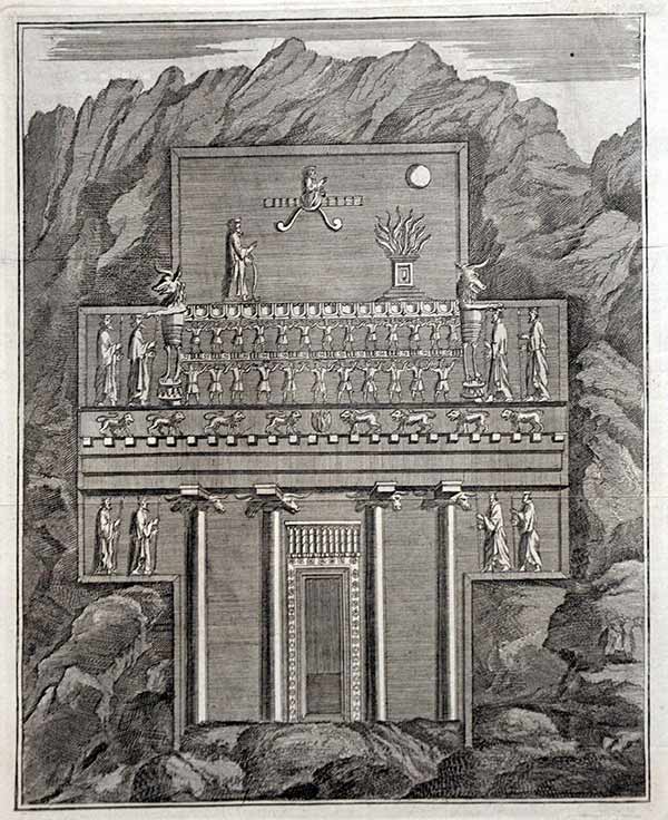
A View of the Ruins of Persepolis as Taken from the Plain No.1.1 the two Beast at the Head of the Grand Staircase A pair of interesting engravings showing the ruins of the ancient Persian city of Persepolis, now in Iran Copperplate engraving on a verge type hand laid paper, with watermark. Original folds. from: 'Voyage au Levant c'est a dire dans les principaux endroits de l'Asie Mineure dans les Isles de Chio, de Rhodes, de Chypre &c., de meme que dans les plus considerables villes d'Egypte, de Syrie, et de la Terre Sainte', by Corneille le Brun (Cornelis de Bruyn), published by Henri de Kroonevelt, Delft, 1700. First edition in French, first published in Dutch in1698 ('Reizen.door de vermaardste Deelen van Klein Asia.') In 1702 an English edition appeared as well. Cornelis de Bruijn (also spelled Cornelius de Bruyn, pronounced (1652 1726/7) was a Dutch artist and traveler. He made two large tours and published illustrated books with his observations of people, buildings, plants and animals. Size . 47 x 37 cm. Image size is 37 x 28 cm. . His drawings of these ruins were a disappointment to his public as they differed from those they had already become familiar with. £125 inc delivery . These are from the 1702 English edition with centre fold

The Remains of two Portals and two columns of the Royal palace of Persepolis A pair of interesting engravings showing the ruins of the ancient Persian city of Persepolis, now in Iran Copperplate engraving on a verge type hand laid paper, with watermark. Original folds. from: 'Voyage au Levant c'est a dire dans les principaux endroits de l'Asie Mineure dans les Isles de Chio, de Rhodes, de Chypre &c., de meme que dans les plus considerables villes d'Egypte, de Syrie, et de la Terre Sainte', by Corneille le Brun (Cornelis de Bruyn), published by Henri de Kroonevelt, Delft, 1700. First edition in French, first published in Dutch in1698 ('Reizen.door de vermaardste Deelen van Klein Asia.') In 1702 an English edition appeared as well. Cornelis de Bruijn (also spelled Cornelius de Bruyn, pronounced (1652 1726/7) was a Dutch artist and traveler. He made two large tours and published illustrated books with his observations of people, buildings, plants and animals. Size . 47 x 37 cm. Image size is 37 x 28 cm. . His drawings of these ruins were a disappointment to his public as they differed from those they had already become familiar with. £125 inc delivery . These are from the 1702 English edition with centre fold
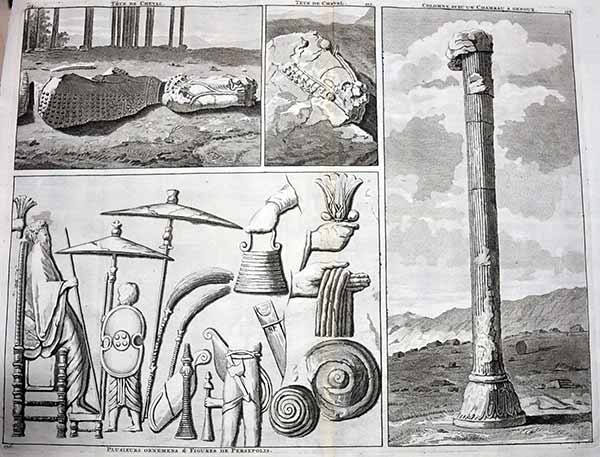
Tete de Cheval / Colomne avec un chameau a genoux / Plusieurs ornemens & figures de Persepolis" -

Ruins of two of the portico's Persepolis as Taken from the Plain No.1.1 the two Beast at the Head of the Grand Staircase by De Bruyn hand tinted plate 1 only £45 inc delivery
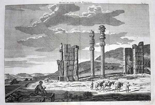
Ruins of two of the portico's Persepolis as Taken from the Plain No.1.1 the two Beast at the Head of the Grand Staircase Copy by Blundell of left of the pair de Bruyn £35 inc delivery . These are from the 1702 English edition with centre fold 2 avail


Pont Hassan-Abaet . . .shows the Pol-e-Khajou bridge in Ispahan
Copperplate engraving on a verge type hand laid paper, with watermark. Original folds. from: 'Voyage au Levant c'est a dire dans les principaux endroits de l'Asie Mineure dans les Isles de Chio, de Rhodes, de Chypre &c., de meme que dans les plus considerables villes d'Egypte, de Syrie, et de la Terre Sainte', by Corneille le Brun (Cornelis de Bruyn), published by Henri de Kroonevelt, Delft, 1700. First edition in French, first published in Dutch in1698 ('Reizen.door de vermaardste Deelen van Klein Asia.') In 1702 an English edition appeared as well. Cornelis de Bruijn (also spelled Cornelius de Bruyn, pronounced (1652 1726/7) was a Dutch artist and traveler. He made two large tours and published illustrated books with his observations of people, buildings, plants and animals. Size . 47 x 37 cm. Image size is 37 x 28 cm. . His drawings of these ruins were a disappointment to his public as they differed from those they had already become familiar with. £65 inc delivery . These are from the 1700 French edition smaller in image size

Icon Tabernaculi ex Aria Montano desumpta This engraving depicts the Tabernacle and shows how it was built. The engraving is embellished with a coat of arms and dedication cartouche. Thomas Fuller (1608-1661) was a respected English clergyman who wrote several books on the history and geography of the Holy Land. His A Pisgah-Sight of Palestine, published in 1650, was a geographical description of the Holy Land with special reference to biblical history. Fuller financed the book by dividing it into sections and finding sponsors for each one. To acknowledge the patrons, all maps contained decorative cartouches with the sponsor's coat of arms and a dedication to him. £75 inc delivery Dimension 1 (Length) 43.0 cm Dimension 2 (Width) 33.5 cm
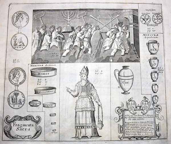
Fragmenta Sacra This engraving depicts various sacred fragments The engraving is embellished with a coat of arms and dedication cartouche. Thomas Fuller (1608-1661) was a respected English clergyman who wrote several books on the history and geography of the Holy Land. His A Pisgah-Sight of Palestine, published in 1650, was a geographical description of the Holy Land with special reference to biblical history. Fuller financed the book by dividing it into sections and finding sponsors for each one. To acknowledge the patrons, all maps contained decorative cartouches with the sponsor's coat of arms and a dedication to him. £75 inc delivery Dimension 1 (Length) 43.0 cm Dimension 2 (Width) 33.5 cm

Persepolis king palace, column
Unattributed engraving of the Two Horses as originally on the pillar at the Kings palace at Persepolis c 1680
** This is a record much of which is now destroyed and carvings sold illegally** If the set is wanted do yell as each includes postage

The Remains of two portals and two columns of the Royal Palace of Persepolis.
By Cornelius le
Bruyn.Published by Travels in the Levant. 1718 (1718) Also
reprinted in An universal history, from the earliest
accounts to the present time in 1744 Copper engraving.
Uncoloured. Cornelis de Bruyn is remembered chiefly for
the records of his extensive travels in Egypt, Persia,
India, and other countries, illustrated with his own
designs., Cornelis de Bruijn (also spelled Cornelius de
Bruyn, (1652-1726/7) was a Dutch artist and traveler. He
made two large tours and published illustrated books with
his observations of people, buildings, plants and animals.
This is the account of De Bruyn's second voyage. He left
The Netherlands in 1701 and sailed to Archangel and on to
Moscow, where he lived for more than a year. In 1703 he
reached Persia, and after nearly another year in Isfahan,
he continued to Persepolis, the ancient Achaemenid palace.
His drawings of these ruins were a disappointment to his
public as they differed from those they had already become
familiar with. £55 inc delivery Complete PAIR above

Other Pieces of the Pilasters
(of Persepolis. )
By Cornelius le
Bruyn.Published by Travels in the Levant. 1718 (1718) Also
reprinted in An universal history, from the earliest
accounts to the present time in 1744 Copper engraving.
Uncoloured. Cornelis de Bruyn is remembered chiefly for
the records of his extensive travels in Egypt, Persia,
India, and other countries, illustrated with his own
designs., Cornelis de Bruijn (also spelled Cornelius de
Bruyn, (1652-1726/7) was a Dutch artist and traveler. He
made two large tours and published illustrated books with
his observations of people, buildings, plants and animals.
This is the account of De Bruyn's second voyage. He left
The Netherlands in 1701 and sailed to Archangel and on to
Moscow, where he lived for more than a year. In 1703 he
reached Persia, and after nearly another year in Isfahan,
he continued to Persepolis, the ancient Achaemenid palace.
His drawings of these ruins were a disappointment to his
public as they differed from those they had already become
familiar with. £55 inc delivery

Portals on the West side of
the Royal palace of Persepolis.
By Cornelius le Bruyn.Published by Travels in the Levant.
1718 (1718) Also reprinted in An universal history,
from the earliest accounts to the present time in 1744
Copper engraving. Uncoloured. Cornelis de Bruyn is
remembered chiefly for the records of his extensive
travels in Egypt, Persia, India, and other countries,
illustrated with his own designs., Cornelis de Bruijn
(also spelled Cornelius de Bruyn, (1652-1726/7) was a
Dutch artist and traveler. He made two large tours and
published illustrated books with his observations of
people, buildings, plants and animals. This is the account
of De Bruyn's second voyage. He left The Netherlands in
1701 and sailed to Archangel and on to Moscow, where he
lived for more than a year. In 1703 he reached Persia, and
after nearly another year in Isfahan, he continued to
Persepolis, the ancient Achaemenid palace. His drawings of
these ruins were a disappointment to his public as they
differed from those they had already become familiar with.
£55 inc delivery
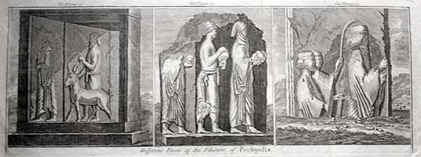
Different Pieces of the
Pilasters of Persepolis.
By Cornelius le Bruyn.Published by Travels in the Levant.
1718 (1718) Also reprinted in An universal history,
from the earliest accounts to the present time in 1744
Copper engraving. Uncoloured. Cornelis de Bruyn is
remembered chiefly for the records of his extensive
travels in Egypt, Persia, India, and other countries,
illustrated with his own designs., Cornelis de Bruijn
(also spelled Cornelius de Bruyn, (1652-1726/7) was a
Dutch artist and traveler. He made two large tours and
published illustrated books with his observations of
people, buildings, plants and animals. This is the account
of De Bruyn's second voyage. He left The Netherlands in
1701 and sailed to Archangel and on to Moscow, where he
lived for more than a year. In 1703 he reached Persia, and
after nearly another year in Isfahan, he continued to
Persepolis, the ancient Achaemenid palace. His drawings of
these ruins were a disappointment to his public as they
differed from those they had already become familiar with.
£55 inc delivery
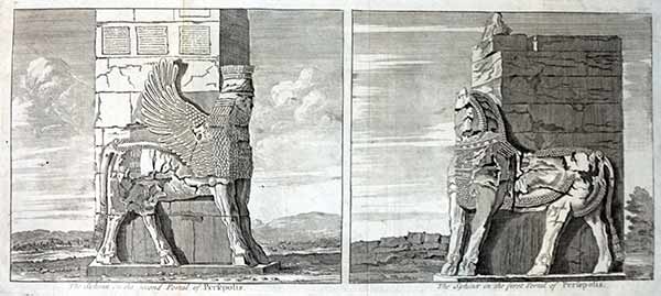
The Sphinx in the second Portal of Persepolis. The Sphinx in the first Portal of Persepolis
By Cornelius le Bruyn.Published by Travels in the Levant. 1718 (1718) Also reprinted in An universal history, from the earliest accounts to the present time in 1744 Copper engraving. Uncoloured. Cornelis de Bruyn is remembered chiefly for the records of his extensive travels in Egypt, Persia, India, and other countries, illustrated with his own designs., Cornelis de Bruijn (also spelled Cornelius de Bruyn, (1652-1726/7) was a Dutch artist and traveler. He made two large tours and published illustrated books with his observations of people, buildings, plants and animals. This is the account of De Bruyn's second voyage. He left The Netherlands in 1701 and sailed to Archangel and on to Moscow, where he lived for more than a year. In 1703 he reached Persia, and after nearly another year in Isfahan, he continued to Persepolis, the ancient Achaemenid palace. His drawings of these ruins were a disappointment to his public as they differed from those they had already become familiar with. £50 inc delivery ** some wear to text on first pic**

A Portal of Persepolis. A Piece of the Side of a Window fill'd with Characters. A Portal of Persepolis.
By Cornelius le Bruyn.Published by Travels in the Levant. 1718 (1718) Also reprinted in An universal history, from the earliest accounts to the present time in 1744 Copper engraving. Uncoloured. Cornelis de Bruyn is remembered chiefly for the records of his extensive travels in Egypt, Persia, India, and other countries, illustrated with his own designs., Cornelis de Bruijn (also spelled Cornelius de Bruyn, (1652-1726/7) was a Dutch artist and traveler. He made two large tours and published illustrated books with his observations of people, buildings, plants and animals. This is the account of De Bruyn's second voyage. He left The Netherlands in 1701 and sailed to Archangel and on to Moscow, where he lived for more than a year. In 1703 he reached Persia, and after nearly another year in Isfahan, he continued to Persepolis, the ancient Achaemenid palace. His drawings of these ruins were a disappointment to his public as they differed from those they had already become familiar with. £45 inc delivery ** some wear to text on first pic also edge tear in margin**
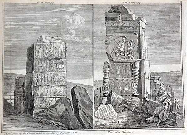
"A Pilaster of the Portal with a number of Figures on it" with "Part of a Pilaster"
By Cornelius le Bruyn.Published by Travels in the Levant. 1718 (1718) Also reprinted in An universal history, from the earliest accounts to the present time in 1744 Copper engraving. Uncoloured. Cornelis de Bruyn is remembered chiefly for the records of his extensive travels in Egypt, Persia, India, and other countries, illustrated with his own designs., Cornelis de Bruijn (also spelled Cornelius de Bruyn, (1652-1726/7) was a Dutch artist and traveler. He made two large tours and published illustrated books with his observations of people, buildings, plants and animals. This is the account of De Bruyn's second voyage. He left The Netherlands in 1701 and sailed to Archangel and on to Moscow, where he lived for more than a year. In 1703 he reached Persia, and after nearly another year in Isfahan, he continued to Persepolis, the ancient Achaemenid palace. His drawings of these ruins were a disappointment to his public as they differed from those they had already become familiar with. £45 inc delivery ** some wear to text on first pic small margin** x 2

Figures on the Pilaster of a Portal Persepolis
By Cornelius le Bruyn.Published by Travels in the Levant. 1718 (1718) Also reprinted in An universal history, from the earliest accounts to the present time in 1744 Copper engraving. Uncoloured. Cornelis de Bruyn is remembered chiefly for the records of his extensive travels in Egypt, Persia, India, and other countries, illustrated with his own designs., Cornelis de Bruijn (also spelled Cornelius de Bruyn, (1652-1726/7) was a Dutch artist and traveler. He made two large tours and published illustrated books with his observations of people, buildings, plants and animals. This is the account of De Bruyn's second voyage. He left The Netherlands in 1701 and sailed to Archangel and on to Moscow, where he lived for more than a year. In 1703 he reached Persia, and after nearly another year in Isfahan, he continued to Persepolis, the ancient Achaemenid palace. His drawings of these ruins were a disappointment to his public as they differed from those they had already become familiar with. £45 inc delivery ** smaller page image 30 x 15**
Doorway Persepolis
By Cornelius le Bruyn.Published by Travels in the Levant. 1718 (1718) Also reprinted in An universal history, from the earliest accounts to the present time in 1744 Copper engraving. Uncoloured. Cornelis de Bruyn is remembered chiefly for the records of his extensive travels in Egypt, Persia, India, and other countries, illustrated with his own designs., Cornelis de Bruijn (also spelled Cornelius de Bruyn, (1652-1726/7) was a Dutch artist and traveler. He made two large tours and published illustrated books with his observations of people, buildings, plants and animals. This is the account of De Bruyn's second voyage. He left The Netherlands in 1701 and sailed to Archangel and on to Moscow, where he lived for more than a year. In 1703 he reached Persia, and after nearly another year in Isfahan, he continued to Persepolis, the ancient Achaemenid palace. His drawings of these ruins were a disappointment to his public as they differed from those they had already become familiar with. £25 ** smaller page image 33x 20.5cm**
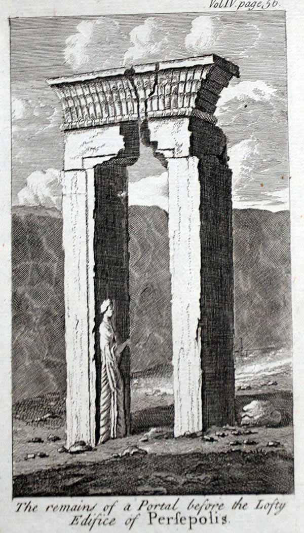
The Remains of a Portal before the Lofty Edifice of Persepolis, ...
Originally by By Cornelius le Bruyn.Published by Travels in the Levant. 1718 (1718) This version smaller and reprinted in An universal history, from the earliest accounts to the present time in 1744 Copper engraving. Uncoloured. Cornelis de Bruyn is remembered chiefly for the records of his extensive travels in Egypt, Persia, India, and other countries, illustrated with his own designs., Cornelis de Bruijn (also spelled Cornelius de Bruyn, (1652-1726/7) was a Dutch artist and traveler. He made two large tours and published illustrated books with his observations of people, buildings, plants and animals. This is the account of De Bruyn's second voyage. He left The Netherlands in 1701 and sailed to Archangel and on to Moscow, where he lived for more than a year. In 1703 he reached Persia, and after nearly another year in Isfahan, he continued to Persepolis, the ancient Achaemenid palace. His drawings of these ruins were a disappointment to his public as they differed from those they had already become familiar with. £15 ** smaller page 10 x 18 cms plus margins with full plate mark**

The Column before the Lofty Edifice of Persepolis, ...
Originally by By Cornelius le Bruyn.Published by Travels in the Levant. 1718 (1718) This version smaller and reprinted in An universal history, from the earliest accounts to the present time in 1744 Copper engraving. Uncoloured. Cornelis de Bruyn is remembered chiefly for the records of his extensive travels in Egypt, Persia, India, and other countries, illustrated with his own designs., Cornelis de Bruijn (also spelled Cornelius de Bruyn, (1652-1726/7) was a Dutch artist and traveler. He made two large tours and published illustrated books with his observations of people, buildings, plants and animals. This is the account of De Bruyn's second voyage. He left The Netherlands in 1701 and sailed to Archangel and on to Moscow, where he lived for more than a year. In 1703 he reached Persia, and after nearly another year in Isfahan, he continued to Persepolis, the ancient Achaemenid palace. His drawings of these ruins were a disappointment to his public as they differed from those they had already become familiar with. £15 ** smaller page 10 x 18 cms plus margins with full plate mark**
By Cornelius le Bruyn.Published by Travels in the Levant. 1718 (1718) Also reprinted in An universal history, from the earliest accounts to the present time in 1744 Copper engraving. Uncoloured. Cornelis de Bruyn is remembered chiefly for the records of his extensive travels in Egypt, Persia, India, and other countries, illustrated with his own designs., Cornelis de Bruijn (also spelled Cornelius de Bruyn, (1652-1726/7) was a Dutch artist and traveler. He made two large tours and published illustrated books with his observations of people, buildings, plants and animals. This is the account of De Bruyn's second voyage. He left The Netherlands in 1701 and sailed to Archangel and on to Moscow, where he lived for more than a year. In 1703 he reached Persia, and after nearly another year in Isfahan, he continued to Persepolis, the ancient Achaemenid palace. His drawings of these ruins were a disappointment to his public as they differed from those they had already become familiar with. £75 inc delivery This is from the Historie Universalle edition
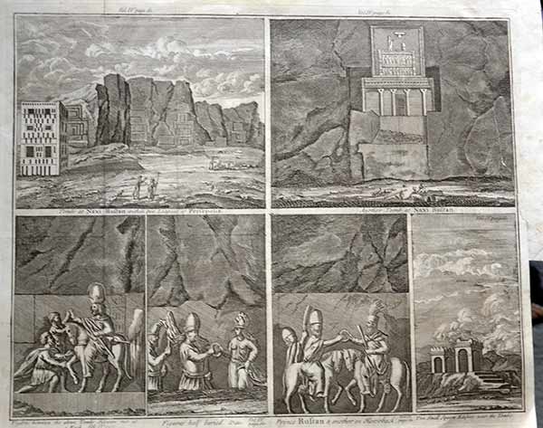
Tombs at Naxi Rustan within two Leagues of Persepolis. Another Tomb at Naxi Rustan. Figures between the above Tombs Hewen out of a Rock.
By Cornelius le Bruyn.Published by Travels in the Levant. 1718 (1718) Also reprinted in An universal history, from the earliest accounts to the present time in 1744 Copper engraving. Uncoloured. Cornelis de Bruyn is remembered chiefly for the records of his extensive travels in Egypt, Persia, India, and other countries, illustrated with his own designs., Cornelis de Bruijn (also spelled Cornelius de Bruyn, (1652-1726/7) was a Dutch artist and traveler. He made two large tours and published illustrated books with his observations of people, buildings, plants and animals. This is the account of De Bruyn's second voyage. He left The Netherlands in 1701 and sailed to Archangel and on to Moscow, where he lived for more than a year. In 1703 he reached Persia, and after nearly another year in Isfahan, he continued to Persepolis, the ancient Achaemenid palace. His drawings of these ruins were a disappointment to his public as they differed from those they had already become familiar with. £75 inc delivery

Nineveh..temple
Temple tire d'une medaille trouvee pres d'une Momie d' Egypte, qui Selon l'opinion des Connoisseurs est un temple de Ninive.
From: Entwurff einer historischen Architectur, in Abbildung unterschiedener berühmten Gebäude, des Alterthums, und fremder Völcker, umb aus den Geschicht-Büchern, Gedächtnüss-Müntzen, Ruinen und eingeholten wahrhafften Abrissen, vor Augen zu stellen By Johann Bernhard Fischer von Erlach,, 1656-1723 published 1721 in Vienna Size 43 x 59 cm. Very rare. Only few books printed.Text- Left: German, right French. Pleasant very light age patina. Wide margins. Some minor traces of age and use such as light creases, light surface soiling blemish to rt would move easily or can get done but stupidly rare £275 inc delivery less collected

A Pyramid outside Thebes Egypt
From: Entwurff einer historischen Architectur, in Abbildung unterschiedener berühmten Gebäude, des Alterthums, und fremder Völcker, umb aus den Geschicht-Büchern, Gedächtnüss-Müntzen, Ruinen und eingeholten wahrhafften Abrissen, vor Augen zu stellen By Johann Bernhard Fischer von Erlach,, 1656-1723 published 1721 in Vienna Size 43 x 59 cm. Very rare. Only few books printed.Text- Left: German, right French. Pleasant very light age patina. Wide margins. Some minor traces of age and use such as light creases, light surface soiling but stupidly rare £285 inc delivery less collected

Nazareth (166/ 167).
By Cornelius le Bruyn.Published by Travels in the Levant. 1718 (1718) Copper engraving. Uncoloured. Cornelis de Bruyn is remembered chiefly for the records of his extensive travels in Egypt, Persia, India, and other countries, illustrated with his own designs., Cornelis de Bruijn (also spelled Cornelius de Bruyn, (1652-1726/7) was a Dutch artist and traveler. He made two large tours and published illustrated books with his observations of people, buildings, plants and animals. This is the account of De Bruyn's second voyage. He left The Netherlands in 1701 and sailed to Archangel and on to Moscow, where he lived for more than a year. In 1703 he reached Persia, and after nearly another year in Isfahan, he continued to Persepolis, the ancient Achaemenid palace. His drawings of these ruins were a disappointment to his public as they differed from those they had already become familiar with. £25 ** smaller page image 33x 20.5cm**
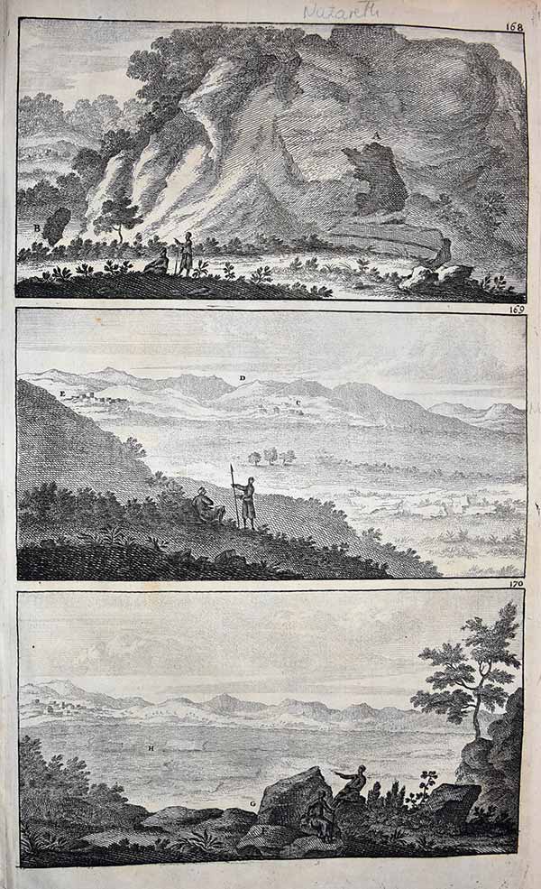
Nazareth 2 (168/ 169 / 170).
By Cornelius le Bruyn.Published by Travels in the Levant. 1718 (1718) Copper engraving. Uncoloured. Cornelis de Bruyn is remembered chiefly for the records of his extensive travels in Egypt, Persia, India, and other countries, illustrated with his own designs., Cornelis de Bruijn (also spelled Cornelius de Bruyn, (1652-1726/7) was a Dutch artist and traveler. He made two large tours and published illustrated books with his observations of people, buildings, plants and animals. This is the account of De Bruyn's second voyage. He left The Netherlands in 1701 and sailed to Archangel and on to Moscow, where he lived for more than a year. In 1703 he reached Persia, and after nearly another year in Isfahan, he continued to Persepolis, the ancient Achaemenid palace. His drawings of these ruins were a disappointment to his public as they differed from those they had already become familiar with. £25 ** smaller page image 33x 20.5cm**
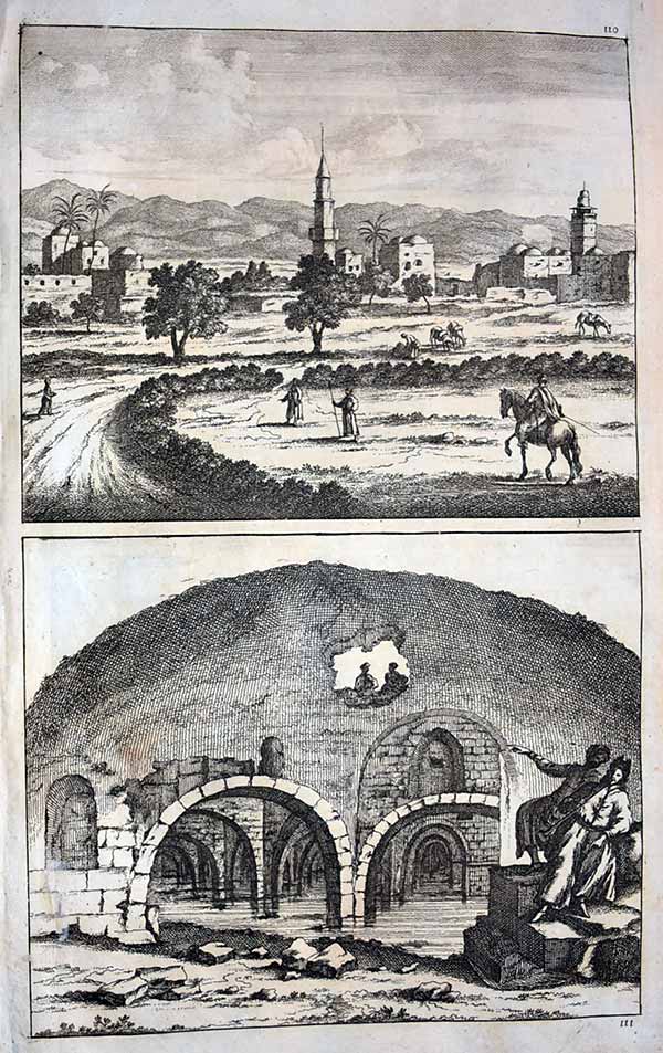
By Cornelius le Bruyn.Published by Travels in the Levant. 1718 (1718) Copper engraving. Uncoloured. Cornelis de Bruyn is remembered chiefly for the records of his extensive travels in Egypt, Persia, India, and other countries, illustrated with his own designs., Cornelis de Bruijn (also spelled Cornelius de Bruyn, (1652-1726/7) was a Dutch artist and traveler. He made two large tours and published illustrated books with his observations of people, buildings, plants and animals. This is the account of De Bruyn's second voyage. He left The Netherlands in 1701 and sailed to Archangel and on to Moscow, where he lived for more than a year. In 1703 he reached Persia, and after nearly another year in Isfahan, he continued to Persepolis, the ancient Achaemenid palace. His drawings of these ruins were a disappointment to his public as they differed from those they had already become familiar with. £25 ** smaller page image 33x 20.5cm**
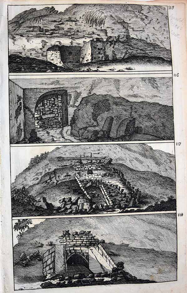
Apostle Peter's Cave (115/ 116 / 117 / 118).
By Cornelius le Bruyn.Published by Travels in the Levant. 1718 (1718) Copper engraving. Uncoloured. Cornelis de Bruyn is remembered chiefly for the records of his extensive travels in Egypt, Persia, India, and other countries, illustrated with his own designs., Cornelis de Bruijn (also spelled Cornelius de Bruyn, (1652-1726/7) was a Dutch artist and traveler. He made two large tours and published illustrated books with his observations of people, buildings, plants and animals. This is the account of De Bruyn's second voyage. He left The Netherlands in 1701 and sailed to Archangel and on to Moscow, where he lived for more than a year. In 1703 he reached Persia, and after nearly another year in Isfahan, he continued to Persepolis, the ancient Achaemenid palace. His drawings of these ruins were a disappointment to his public as they differed from those they had already become familiar with. £25 ** smaller page image 33x 20.5cm**

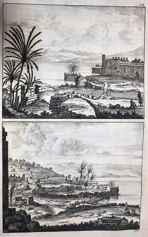
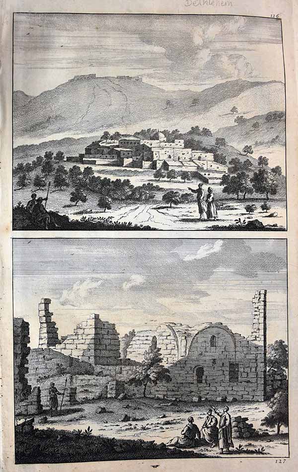
Galilee (170/ 171 / 172).
By Cornelius le Bruyn.Published by Travels in the Levant. 1718 (1718) Copper engraving. Uncoloured. Cornelis de Bruyn is remembered chiefly for the records of his extensive travels in Egypt, Persia, India, and other countries, illustrated with his own designs., Cornelis de Bruijn (also spelled Cornelius de Bruyn, (1652-1726/7) was a Dutch artist and traveler. He made two large tours and published illustrated books with his observations of people, buildings, plants and animals. This is the account of De Bruyn's second voyage. He left The Netherlands in 1701 and sailed to Archangel and on to Moscow, where he lived for more than a year. In 1703 he reached Persia, and after nearly another year in Isfahan, he continued to Persepolis, the ancient Achaemenid palace. His drawings of these ruins were a disappointment to his public as they differed from those they had already become familiar with. £25 ** smaller page image 33x 20.5cm**
By Cornelius le Bruyn.Published by Travels in the Levant. 1718 (1718) Copper engraving. Uncoloured. Cornelis de Bruyn is remembered chiefly for the records of his extensive travels in Egypt, Persia, India, and other countries, illustrated with his own designs., Cornelis de Bruijn (also spelled Cornelius de Bruyn, (1652-1726/7) was a Dutch artist and traveler. He made two large tours and published illustrated books with his observations of people, buildings, plants and animals. This is the account of De Bruyn's second voyage. He left The Netherlands in 1701 and sailed to Archangel and on to Moscow, where he lived for more than a year. In 1703 he reached Persia, and after nearly another year in Isfahan, he continued to Persepolis, the ancient Achaemenid palace. His drawings of these ruins were a disappointment to his public as they differed from those they had already become familiar with. £25 ** smaller page image 33x 20.5cm**

By Cornelius le Bruyn.Published by Travels in the Levant. 1718 (1718) Copper engraving. Uncoloured. Cornelis de Bruyn is remembered chiefly for the records of his extensive travels in Egypt, Persia, India, and other countries, illustrated with his own designs., Cornelis de Bruijn (also spelled Cornelius de Bruyn, (1652-1726/7) was a Dutch artist and traveler. He made two large tours and published illustrated books with his observations of people, buildings, plants and animals. This is the account of De Bruyn's second voyage. He left The Netherlands in 1701 and sailed to Archangel and on to Moscow, where he lived for more than a year. In 1703 he reached Persia, and after nearly another year in Isfahan, he continued to Persepolis, the ancient Achaemenid palace. His drawings of these ruins were a disappointment to his public as they differed from those they had already become familiar with. £25 ** smaller page image 33x 20.5cm**
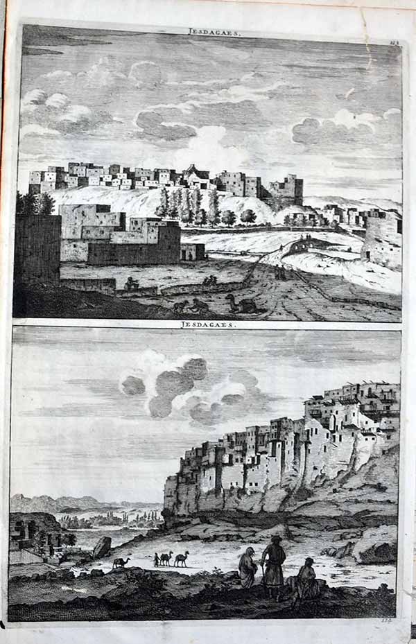
Jesdagaes (123 / 124). Izad Khast in Iran
By Cornelius le Bruyn.Published by Travels in the Levant. 1718 (1718) Copper engraving. Uncoloured. Cornelis de Bruyn is remembered chiefly for the records of his extensive travels in Egypt, Persia, India, and other countries, illustrated with his own designs., Cornelis de Bruijn (also spelled Cornelius de Bruyn, (1652-1726/7) was a Dutch artist and traveler. He made two large tours and published illustrated books with his observations of people, buildings, plants and animals. This is the account of De Bruyn's second voyage. He left The Netherlands in 1701 and sailed to Archangel and on to Moscow, where he lived for more than a year. In 1703 he reached Persia, and after nearly another year in Isfahan, he continued to Persepolis, the ancient Achaemenid palace. His drawings of these ruins were a disappointment to his public as they differed from those they had already become familiar with. £25 ** smaller page image 33x 20.5cm**repaired rear top edge
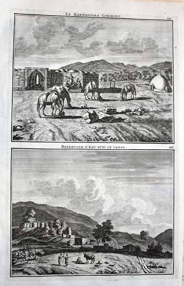
Le Kaewansera Gormoet + Resevoir d'eau avec le Canal (235/236). Caravan resting + Canal + Resevroir in Iran
By Cornelius le Bruyn.Published by Travels in the Levant. 1718 (1718) Copper engraving. Uncoloured. Cornelis de Bruyn is remembered chiefly for the records of his extensive travels in Egypt, Persia, India, and other countries, illustrated with his own designs., Cornelis de Bruijn (also spelled Cornelius de Bruyn, (1652-1726/7) was a Dutch artist and traveler. He made two large tours and published illustrated books with his observations of people, buildings, plants and animals. This is the account of De Bruyn's second voyage. He left The Netherlands in 1701 and sailed to Archangel and on to Moscow, where he lived for more than a year. In 1703 he reached Persia, and after nearly another year in Isfahan, he continued to Persepolis, the ancient Achaemenid palace. His drawings of these ruins were a disappointment to his public as they differed from those they had already become familiar with. £25 ** smaller page image 33x 20.5cm**
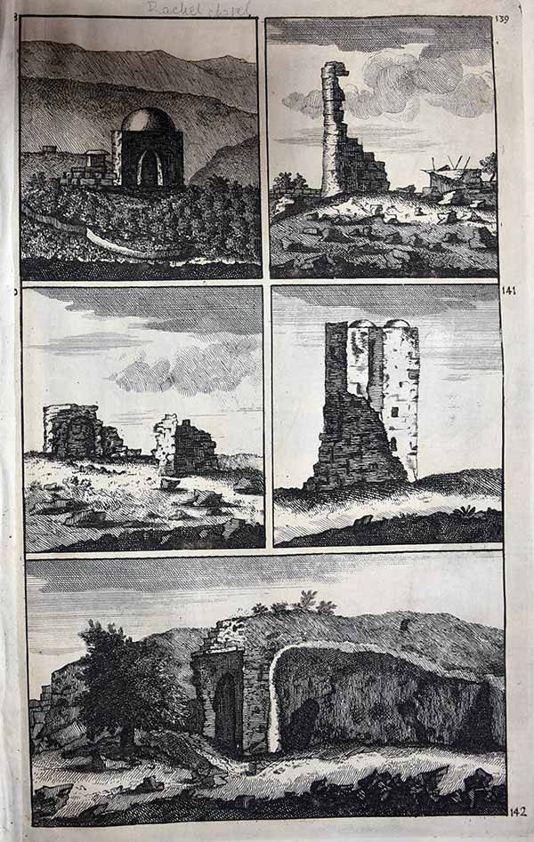
Rachel's Chapel (139 / 142).
By Cornelius le Bruyn.Published by Travels in the Levant. 1718 (1718) Copper engraving. Uncoloured. Cornelis de Bruyn is remembered chiefly for the records of his extensive travels in Egypt, Persia, India, and other countries, illustrated with his own designs., Cornelis de Bruijn (also spelled Cornelius de Bruyn, (1652-1726/7) was a Dutch artist and traveler. He made two large tours and published illustrated books with his observations of people, buildings, plants and animals. This is the account of De Bruyn's second voyage. He left The Netherlands in 1701 and sailed to Archangel and on to Moscow, where he lived for more than a year. In 1703 he reached Persia, and after nearly another year in Isfahan, he continued to Persepolis, the ancient Achaemenid palace. His drawings of these ruins were a disappointment to his public as they differed from those they had already become familiar with. £25 ** smaller page image 33x 20.5cm**


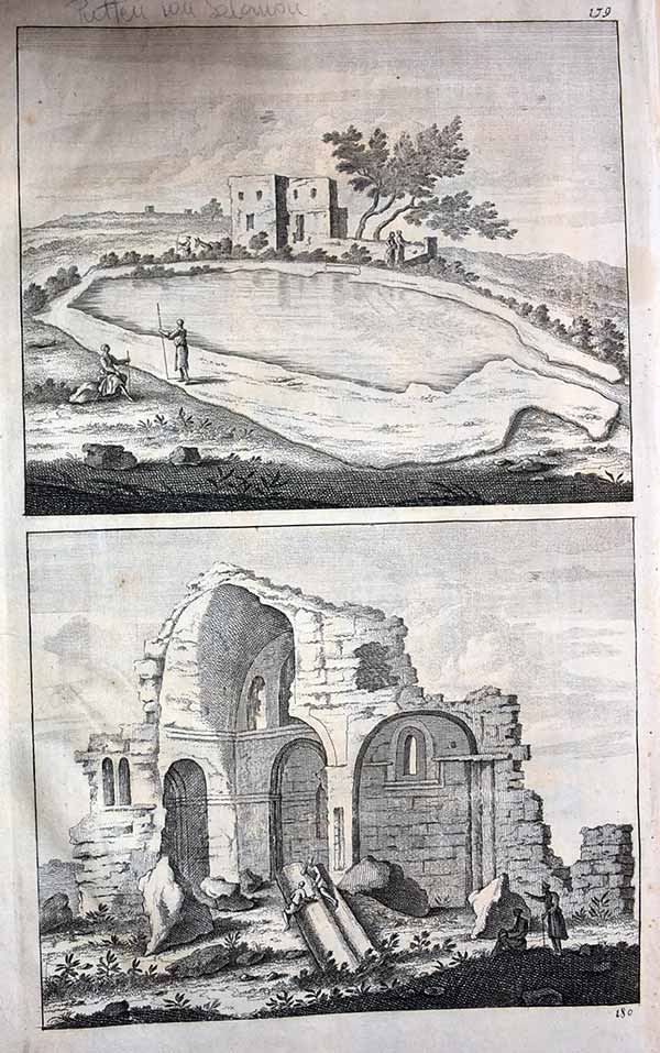
Ma-zjit Madre Sulemeon +Figures sur le Rocher (179 / 18).
By Cornelius le Bruyn.Published by Travels in the Levant. 1718 (1718) Copper engraving. Uncoloured. Cornelis de Bruyn is remembered chiefly for the records of his extensive travels in Egypt, Persia, India, and other countries, illustrated with his own designs., Cornelis de Bruijn (also spelled Cornelius de Bruyn, (1652-1726/7) was a Dutch artist and traveler. He made two large tours and published illustrated books with his observations of people, buildings, plants and animals. This is the account of De Bruyn's second voyage. He left The Netherlands in 1701 and sailed to Archangel and on to Moscow, where he lived for more than a year. In 1703 he reached Persia, and after nearly another year in Isfahan, he continued to Persepolis, the ancient Achaemenid palace. His drawings of these ruins were a disappointment to his public as they differed from those they had already become familiar with. £25 ** smaller page image 33x 20.5cm**
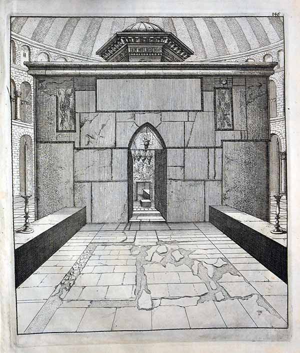
Entrance to the Holy Sepulchre in Jerusalem (146).
By Cornelius le Bruyn.Published by Travels in the Levant. 1718 (1718) Copper engraving. Uncoloured. Cornelis de Bruyn is remembered chiefly for the records of his extensive travels in Egypt, Persia, India, and other countries, illustrated with his own designs., Cornelis de Bruijn (also spelled Cornelius de Bruyn, (1652-1726/7) was a Dutch artist and traveler. He made two large tours and published illustrated books with his observations of people, buildings, plants and animals. This is the account of De Bruyn's second voyage. He left The Netherlands in 1701 and sailed to Archangel and on to Moscow, where he lived for more than a year. In 1703 he reached Persia, and after nearly another year in Isfahan, he continued to Persepolis, the ancient Achaemenid palace. His drawings of these ruins were a disappointment to his public as they differed from those they had already become familiar with. £25 ** smaller page image 33x 20.5cm**
Pool of Solomon (179 / 180).
By Cornelius le Bruyn.Published by Travels in the Levant. 1718 (1718) Copper engraving. Uncoloured. Cornelis de Bruyn is remembered chiefly for the records of his extensive travels in Egypt, Persia, India, and other countries, illustrated with his own designs., Cornelis de Bruijn (also spelled Cornelius de Bruyn, (1652-1726/7) was a Dutch artist and traveler. He made two large tours and published illustrated books with his observations of people, buildings, plants and animals. This is the account of De Bruyn's second voyage. He left The Netherlands in 1701 and sailed to Archangel and on to Moscow, where he lived for more than a year. In 1703 he reached Persia, and after nearly another year in Isfahan, he continued to Persepolis, the ancient Achaemenid palace. His drawings of these ruins were a disappointment to his public as they differed from those they had already become familiar with. £25 ** smaller page image 33x 20.5cm**

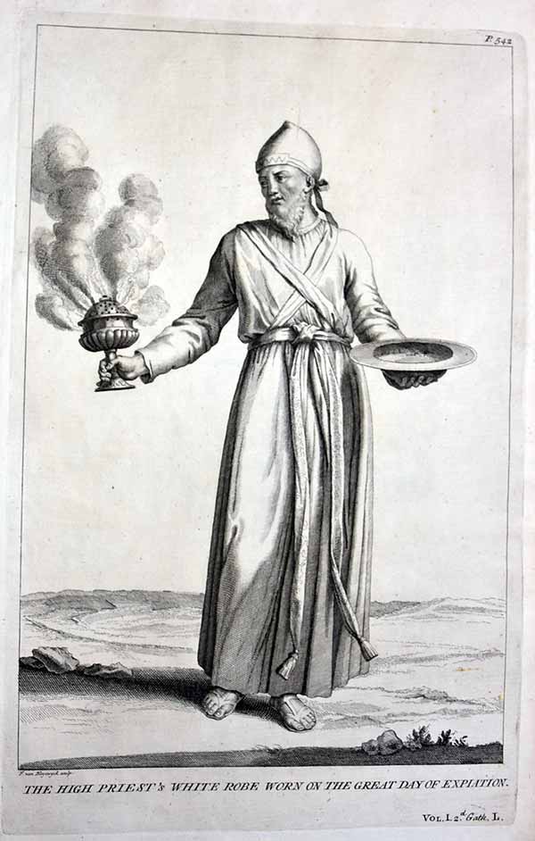
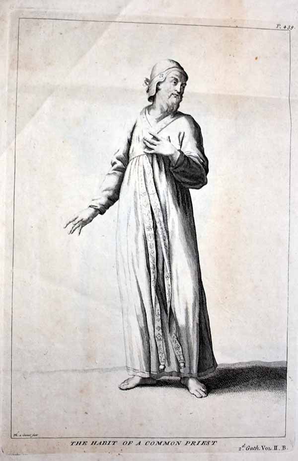

The Ceremonial Habit of the Kings of Israel.
Description de l'Égypte ou recueil des observations et des recherches qui ont été faites en Égypte pendant l'expédition de l'armée francaise. published in Paris, by C.L.F. Panckoucke, 1820-1829, containing 897 ( may folded) engraved views plates by J. BARRABAND, P.J. REDOUTÉ, G. SAINT-HILAIRE and J-C. SAVIGNY. During 1798, Napoléon convinced the "Directoire" that it would be better to aim at conquering Egypte rather than attacking Great Britain and swiftly (and secretly) began his preparations for this expedition. In a very short time he had organized his forces (200 ships and roughly 35.000 troups) and, importantly because it was the guise that kept his military intents secret, a commission of scientists and numerous accompanying artists and technicians. They sailed off to their destination in May 1798. After having conquered the island of Malta within ten days, Napoleon succesfully deluded the English into believing that his intent was to sail on to Turkey. He first landed in Alexandria, where his troups disembarked, and after having conquered Alexandria, marched on to Cairo. The scientists and other members of the scientific commission remained on board and eventually reached Cairo via the Nile. There their scientific work gained momentum, despite several severe setbacks (i.a. loss of valuable scientific instruments) and, although many of the troops and artists, technicians and scientists did not survive the Egyptian campaign, the results of their immense and deeply impressive research reached France in 1801, where it took over 300 men 18 years of work to create this i work, which formed the basis of all subsequent research in the 19th century on the history of Egypt.
The first test volumes of engravings were presented to Napoleon in January 1808. Initially published by order of the emperor (Napoleon le Grand), successive volumes would be published by order of the king, and the last simply by order of the government.
A second edition (known as the Panckoucke edition) was published by Charles Louis Fleury Panckoucke. The text was expanded in more volumes and printed in a smaller format, new pulls were taken from the plates, and these were bound with many of the large format plates folded in the smaller format volumes.
"As this had various editions on various papers plus many had an embossed seal to the page I will identify if the seal is present and if on rag paper ONLY. They will all be early editions of some age and not modern reprints "
Sorry personal circumstances at present this is the best I can do

Plate 3 / Interior of the house of Sultan Hasan in Cairo
Single double Folio plate from 'Description de l'Egypte',
by the French government detailing the results of the
Napoleon's military and scientific expedition to
Egypt (1798-1801) the first comprehensive illustrated
description of ancient and modern Egypt. In 1798, Napoleon
embarked on his expedition to Egypt 'opening'
the enigmatic kingdom to the West. Conquering Egypt, the
geographical centerpoint in the axis of trade between
Europe, India and the East, was an integral part of
Bonaparte's strategic plan for domination. Among the
civilians accompanying him, were the leading French
scholars, artists, scientists, engineers and
technicians, commissioned to compile a thorough
survey of every aspect of Egypt that could be used to plan
the countries future . The survey was divided into
the antiquities, architecture, natural history and
topography of Egypt coordinated by the 'l'Institut
de l'Egypte' . Following the defeat of the French army,
they returned to France to edit and supervise the
work's production. Begun in 1809, 'Description de
l'Egypte' was finally completed in 1830. The plates
from this work provided the first true glimpse
and influenced how the west perceived Egypt.
Published Paris: L'Imprimerie Imperiale, 1809-1813;
l'Imprimerie Royale, 1817- Extremely fine hand colour
£175 inc delivery official
embossed mark indicating the Pancoucke edition
top right
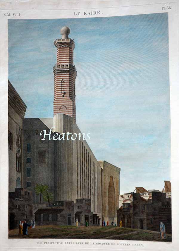
Plate 38 / Perspective exterior of the mosque of Sultan Hasan in Cairo
Single double Folio plate from 'Description de l'Egypte', by the French government detailing the results of the Napoleon's military and scientific expedition to Egypt (1798-1801) the first comprehensive illustrated description of ancient and modern Egypt. In 1798, Napoleon embarked on his expedition to Egypt 'opening' the enigmatic kingdom to the West. Conquering Egypt, the geographical centerpoint in the axis of trade between Europe, India and the East, was an integral part of Bonaparte's strategic plan for domination. Among the civilians accompanying him, were the leading French scholars, artists, scientists, engineers and technicians, commissioned to compile a thorough survey of every aspect of Egypt that could be used to plan the countries future . The survey was divided into the antiquities, architecture, natural history and topography of Egypt coordinated by the 'l'Institut de l'Egypte' . Following the defeat of the French army, they returned to France to edit and supervise the work's production. Begun in 1809, 'Description de l'Egypte' was finally completed in 1830. The plates from this work provided the first true glimpse and influenced how the west perceived Egypt. Published Paris: L'Imprimerie Imperiale, 1809-1813; l'Imprimerie Royale, 1817- Extremely fine hand colour £175 inc delivery official embossed mark indicating the Pancoucke edition top right
Pic to follow archaeologists to foreground
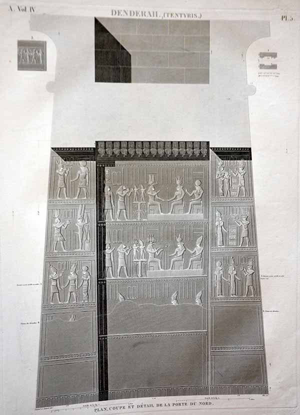
Plate 5 / View of Ruins at Memphis
Single double Folio plate from 'Description de l'Egypte', by the French government detailing the results of the Napoleon's military and scientific expedition to Egypt (1798-1801) the first comprehensive illustrated description of ancient and modern Egypt. In 1798, Napoleon embarked on his expedition to Egypt 'opening' the enigmatic kingdom to the West. Conquering Egypt, the geographical centerpoint in the axis of trade between Europe, India and the East, was an integral part of Bonaparte's strategic plan for domination. Among the civilians accompanying him, were the leading French scholars, artists, scientists, engineers and technicians, commissioned to compile a thorough survey of every aspect of Egypt that could be used to plan the countries future . The survey was divided into the antiquities, architecture, natural history and topography of Egypt coordinated by the 'l'Institut de l'Egypte' . Following the defeat of the French army, they returned to France to edit and supervise the work's production. Begun in 1809, 'Description de l'Egypte' was finally completed in 1830. The plates from this work provided the first true glimpse and influenced how the west perceived Egypt. Published Paris: L'Imprimerie Imperiale, 1809-1813; l'Imprimerie Royale, 1817- . Extremely fine hand colour £175 inc delivery

Plate 28/ View of the Ancient Mosque of Bab el Nash nr Cairo
Single double Folio plate from 'Description de l'Egypte', by the French government detailing the results of the Napoleon's military and scientific expedition to Egypt (1798-1801) the first comprehensive illustrated description of ancient and modern Egypt. In 1798, Napoleon embarked on his expedition to Egypt 'opening' the enigmatic kingdom to the West. Conquering Egypt, the geographical centerpoint in the axis of trade between Europe, India and the East, was an integral part of Bonaparte's strategic plan for domination. Among the civilians accompanying him, were the leading French scholars, artists, scientists, engineers and technicians, commissioned to compile a thorough survey of every aspect of Egypt that could be used to plan the countries future . The survey was divided into the antiquities, architecture, natural history and topography of Egypt coordinated by the 'l'Institut de l'Egypte' . Following the defeat of the French army, they returned to France to edit and supervise the work's production. Begun in 1809, 'Description de l'Egypte' was finally completed in 1830. The plates from this work provided the first true glimpse and influenced how the west perceived Egypt. Published Paris: L'Imprimerie Imperiale, 1809-1813; l'Imprimerie Royale, 1817- Extremely fine hand colour £175 inc delivery official embossed mark indicating the Pancoucke edition top right
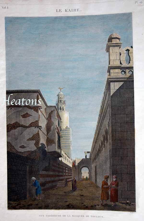
Plate 29 / Exterior of the Mosque at Toulon nr Cairo
Single double Folio plate from 'Description de l'Egypte', by the French government detailing the results of the Napoleon's military and scientific expedition to Egypt (1798-1801) the first comprehensive illustrated description of ancient and modern Egypt. In 1798, Napoleon embarked on his expedition to Egypt 'opening' the enigmatic kingdom to the West. Conquering Egypt, the geographical centerpoint in the axis of trade between Europe, India and the East, was an integral part of Bonaparte's strategic plan for domination. Among the civilians accompanying him, were the leading French scholars, artists, scientists, engineers and technicians, commissioned to compile a thorough survey of every aspect of Egypt that could be used to plan the countries future . The survey was divided into the antiquities, architecture, natural history and topography of Egypt coordinated by the 'l'Institut de l'Egypte' . Following the defeat of the French army, they returned to France to edit and supervise the work's production. Begun in 1809, 'Description de l'Egypte' was finally completed in 1830. The plates from this work provided the first true glimpse and influenced how the west perceived Egypt. Published Paris: L'Imprimerie Imperiale, 1809-1813; l'Imprimerie Royale, 1817- Extremely fine hand colour £175 inc delivery official embossed mark indicating the Pancoucke edition top right

Vue de la roue à pots ou machine à arroser. ( volume II, planche V
Copper engraving. Sheet size: 21 3/8 x 27 5/8 inches. Plate mark: 13 5/8 x 19 1/8 inches.P late from 'Description de l'Egypte', by the French government detailing the results of the Napoleon's military and scientific expedition to Egypt (1798-1801) the first comprehensive illustrated description of ancient and modern Egypt. In 1798, Napoleon embarked on his expedition to Egypt 'opening' the enigmatic kingdom to the West. Conquering Egypt, the geographical centerpoint in the axis of trade between Europe, India and the East, was an integral part of Bonaparte's strategic plan for domination. Among the civilians accompanying him, were the leading French scholars, artists, scientists, engineers and technicians, commissioned to compile a thorough survey of every aspect of Egypt that could be used to plan the countries future . The survey was divided into the antiquities, architecture, natural history and topography of Egypt coordinated by the 'l'Institut de l'Egypte' . Following the defeat of the French army, they returned to France to edit and supervise the work's production. Begun in 1809, 'Description de l'Egypte' was finally completed in 1830. The plates from this work provided the first true glimpse and influenced how the west perceived Egypt. Published Paris: L'Imprimerie Imperiale, 1809-1813; l'Imprimerie Royale, 1817- They have the centre fold as issued and seem to have traces of a horizontal fold on some. No official embossed mark indicating the Pancoucke edition top right plus creasing in margin/plate area £125
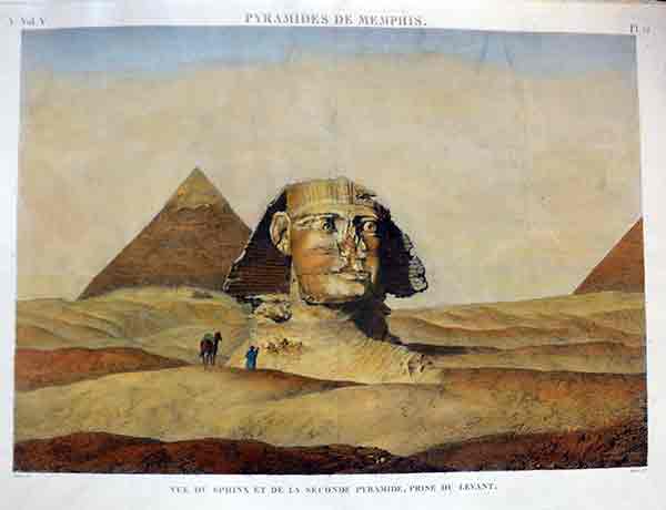
Sphinx/ + Pyramids at Memphis/ Vue de sphinx et de la seconde pyramide, prise du levant.
Copper engraving. Sheet size: 21 3/8 x 27 5/8 inches. .Plate from 'Description de l'Egypte', by the French government detailing the results of the Napoleon's military and scientific expedition to Egypt (1798-1801) the first comprehensive illustrated description of ancient and modern Egypt. In 1798, Napoleon embarked on his expedition to Egypt 'opening' the enigmatic kingdom to the West. Conquering Egypt, the geographical centerpoint in the axis of trade between Europe, India and the East, was an integral part of Bonaparte's strategic plan for domination. Among the civilians accompanying him, were the leading French scholars, artists, scientists, engineers and technicians, commissioned to compile a thorough survey of every aspect of Egypt that could be used to plan the countries future . The survey was divided into the antiquities, architecture, natural history and topography of Egypt coordinated by the 'l'Institut de l'Egypte' . Following the defeat of the French army, they returned to France to edit and supervise the work's production. Begun in 1809, 'Description de l'Egypte' was finally completed in 1830. The plates from this work provided the first true glimpse and influenced how the west perceived Egypt. Published Paris: L'Imprimerie Imperiale, 1809-1813; l'Imprimerie Royale, 1817- They have the centre fold as issued and seem to have traces of a horizontal fold on some. Extremely fine hand colour @£125 inc delivery Much cheaper collected due to size ******extensive creasing in sky area so reduced ***** No official embossed mark

Cairo /Le Kaire. Vue du Jardin et de l'Étang de Qasim Bey [Pl. 44, Vol. I]
Copper engraving. Sheet size: 21 3/8 x 27 5/8 inches. Plate mark: 13 5/8 x 19 1/8 inches.P late from 'Description de l'Egypte', by the French government detailing the results of the Napoleon's military and scientific expedition to Egypt (1798-1801) the first comprehensive illustrated description of ancient and modern Egypt. In 1798, Napoleon embarked on his expedition to Egypt 'opening' the enigmatic kingdom to the West. Conquering Egypt, the geographical centerpoint in the axis of trade between Europe, India and the East, was an integral part of Bonaparte's strategic plan for domination. Among the civilians accompanying him, were the leading French scholars, artists, scientists, engineers and technicians, commissioned to compile a thorough survey of every aspect of Egypt that could be used to plan the countries future . The survey was divided into the antiquities, architecture, natural history and topography of Egypt coordinated by the 'l'Institut de l'Egypte' . Following the defeat of the French army, they returned to France to edit and supervise the work's production. Begun in 1809, 'Description de l'Egypte' was finally completed in 1830. The plates from this work provided the first true glimpse and influenced how the west perceived Egypt. Published Paris: L'Imprimerie Imperiale, 1809-1813; l'Imprimerie Royale, 1817- They have the centre fold as issued and seem to have traces of a horizontal fold on some. Exrtremely fine hand colour @£220 inc delivery Much cheaper collected due to size

Cairo / Le Kaire [Le Caire]. Vue de la citadelle du côté de la porte du Moqattam. (volume I, planche 68)
The Saladin Citadel of Cairo is a medieval Islamic fortification in Cairo, Egypt. The location, on Mokattam hill near the center of Cairo, Copper engraving. Sheet size: 21 3/8 x 27 5/8 inches. Plate mark: 13 5/8 x 19 1/8 inches.P late from 'Description de l'Egypte', by the French government detailing the results of the Napoleon's military and scientific expedition to Egypt (1798-1801) the first comprehensive illustrated description of ancient and modern Egypt. In 1798, Napoleon embarked on his expedition to Egypt 'opening' the enigmatic kingdom to the West. Conquering Egypt, the geographical centerpoint in the axis of trade between Europe, India and the East, was an integral part of Bonaparte's strategic plan for domination. Among the civilians accompanying him, were the leading French scholars, artists, scientists, engineers and technicians, commissioned to compile a thorough survey of every aspect of Egypt that could be used to plan the countries future . The survey was divided into the antiquities, architecture, natural history and topography of Egypt coordinated by the 'l'Institut de l'Egypte' . Following the defeat of the French army, they returned to France to edit and supervise the work's production. Begun in 1809, 'Description de l'Egypte' was finally completed in 1830. The plates from this work provided the first true glimpse and influenced how the west perceived Egypt. Published Paris: L'Imprimerie Imperiale, 1809-1813; l'Imprimerie Royale, 1817- The have the centre fold as issued and seem to have traces of a horizontal fold on some. Exrtremely fine hand colour @£220 inc delivery Much cheaper collected due to size

Cairo Le Kaire [Le Caire]. Vue de la ville des tombeaux, prise de la citadelle. ( volume I, planche 62)
Copper engraving. Sheet size: 21 3/8 x 27 5/8 inches. Plate mark: 13 5/8 x 19 1/8 inches.P late from 'Description de l'Egypte', by the French government detailing the results of the Napoleon's military and scientific expedition to Egypt (1798-1801) the first comprehensive illustrated description of ancient and modern Egypt. In 1798, Napoleon embarked on his expedition to Egypt 'opening' the enigmatic kingdom to the West. Conquering Egypt, the geographical centerpoint in the axis of trade between Europe, India and the East, was an integral part of Bonaparte's strategic plan for domination. Among the civilians accompanying him, were the leading French scholars, artists, scientists, engineers and technicians, commissioned to compile a thorough survey of every aspect of Egypt that could be used to plan the countries future . The survey was divided into the antiquities, architecture, natural history and topography of Egypt coordinated by the 'l'Institut de l'Egypte' . Following the defeat of the French army, they returned to France to edit and supervise the work's production. Begun in 1809, 'Description de l'Egypte' was finally completed in 1830. The plates from this work provided the first true glimpse and influenced how the west perceived Egypt. Published Paris: L'Imprimerie Imperiale, 1809-1813; l'Imprimerie Royale, 1817- The have the centre fold as issued and seem to have traces of a horizontal fold on some. Exrtremely fine hand colour @£220 inc delivery Much cheaper collected due to size

42 Perspective Interior of the Palace at Karnak
Single double Folio plate from 'Description de l'Egypte', by the French government detailing the results of the Napoleon's military and scientific expedition to Egypt (1798-1801) the first comprehensive illustrated description of ancient and modern Egypt. In 1798, Napoleon embarked on his expedition to Egypt 'opening' the enigmatic kingdom to the West. Conquering Egypt, the geographical centerpoint in the axis of trade between Europe, India and the East, was an integral part of Bonaparte's strategic plan for domination. Among the civilians accompanying him, were the leading French scholars, artists, scientists, engineers and technicians, commissioned to compile a thorough survey of every aspect of Egypt that could be used to plan the countries future . The survey was divided into the antiquities, architecture, natural history and topography of Egypt coordinated by the 'l'Institut de l'Egypte' . Following the defeat of the French army, they returned to France to edit and supervise the work's production. Begun in 1809, 'Description de l'Egypte' was finally completed in 1830. The plates from this work provided the first true glimpse and influenced how the west perceived Egypt. Published Paris: L'Imprimerie Imperiale, 1809-1813; l'Imprimerie Royale, 1817- .uncoloured official embossed mark indicating the Pancoucke edition top right £125 inc delivery
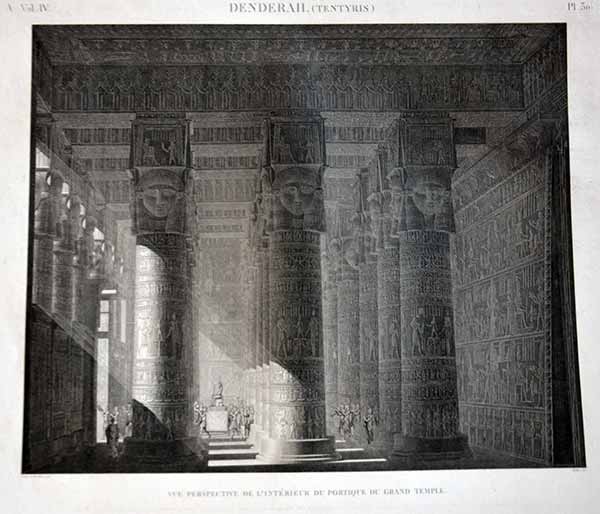
30 Perspective Interior of the Portico of the Temple at Tentyris /Dendera
Single double Folio plate from 'Description de l'Egypte', by the French government detailing the results of the Napoleon's military and scientific expedition to Egypt (1798-1801) the first comprehensive illustrated description of ancient and modern Egypt. In 1798, Napoleon embarked on his expedition to Egypt 'opening' the enigmatic kingdom to the West. Conquering Egypt, the geographical centerpoint in the axis of trade between Europe, India and the East, was an integral part of Bonaparte's strategic plan for domination. Among the civilians accompanying him, were the leading French scholars, artists, scientists, engineers and technicians, commissioned to compile a thorough survey of every aspect of Egypt that could be used to plan the countries future . The survey was divided into the antiquities, architecture, natural history and topography of Egypt coordinated by the 'l'Institut de l'Egypte' . Following the defeat of the French army, they returned to France to edit and supervise the work's production. Begun in 1809, 'Description de l'Egypte' was finally completed in 1830. The plates from this work provided the first true glimpse and influenced how the west perceived Egypt. Published Paris: L'Imprimerie Imperiale, 1809-1813; l'Imprimerie Royale, 1817- .uncoloured £125 inc delivery official embossed mark indicating the Pancoucke edition top right

18
Perspective Interior of the Portico of the Temple at Philae
Single double Folio plate from 'Description de l'Egypte', by the French government detailing the results of the Napoleon's military and scientific expedition to Egypt (1798-1801) the first comprehensive illustrated description of ancient and modern Egypt. In 1798, Napoleon embarked on his expedition to Egypt 'opening' the enigmatic kingdom to the West. Conquering Egypt, the geographical centerpoint in the axis of trade between Europe, India and the East, was an integral part of Bonaparte's strategic plan for domination. Among the civilians accompanying him, were the leading French scholars, artists, scientists, engineers and technicians, commissioned to compile a thorough survey of every aspect of Egypt that could be used to plan the countries future . The survey was divided into the antiquities, architecture, natural history and topography of Egypt coordinated by the 'l'Institut de l'Egypte' . Following the defeat of the French army, they returned to France to edit and supervise the work's production. Begun in 1809, 'Description de l'Egypte' was finally completed in 1830. The plates from this work provided the first true glimpse and influenced how the west perceived Egypt. Published Paris: L'Imprimerie Imperiale, 1809-1813; l'Imprimerie Royale, 1817- .uncoloured £125 inc delivery No official embossed mark
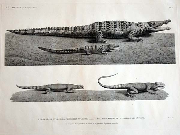
Nile Crocodile
Single double Folio plate from 'Description de l'Egypte', by the French government detailing the results of the Napoleon's military and scientific expedition to Egypt (1798-1801) the first comprehensive illustrated description of ancient and modern Egypt. In 1798, Napoleon embarked on his expedition to Egypt 'opening' the enigmatic kingdom to the West. Conquering Egypt, the geographical centerpoint in the axis of trade between Europe, India and the East, was an integral part of Bonaparte's strategic plan for domination. Among the civilians accompanying him, were the leading French scholars, artists, scientists, engineers and technicians, commissioned to compile a thorough survey of every aspect of Egypt that could be used to plan the countries future . The survey was divided into the antiquities, architecture, natural history and topography of Egypt coordinated by the 'l'Institut de l'Egypte' . Following the defeat of the French army, they returned to France to edit and supervise the work's production. Begun in 1809, 'Description de l'Egypte' was finally completed in 1830. The plates from this work provided the first true glimpse and influenced how the west perceived Egypt. Published Paris: L'Imprimerie Imperiale, 1809-1813; l'Imprimerie Royale, 1817- .uncoloured £125 inc delivery
5 Door at Tentyris /Dendera
Single double Folio plate from 'Description de l'Egypte', by the French government detailing the results of the Napoleon's military and scientific expedition to Egypt (1798-1801) the first comprehensive illustrated description of ancient and modern Egypt. In 1798, Napoleon embarked on his expedition to Egypt 'opening' the enigmatic kingdom to the West. Conquering Egypt, the geographical centerpoint in the axis of trade between Europe, India and the East, was an integral part of Bonaparte's strategic plan for domination. Among the civilians accompanying him, were the leading French scholars, artists, scientists, engineers and technicians, commissioned to compile a thorough survey of every aspect of Egypt that could be used to plan the countries future . The survey was divided into the antiquities, architecture, natural history and topography of Egypt coordinated by the 'l'Institut de l'Egypte' . Following the defeat of the French army, they returned to France to edit and supervise the work's production. Begun in 1809, 'Description de l'Egypte' was finally completed in 1830. The plates from this work provided the first true glimpse and influenced how the west perceived Egypt. Published Paris: L'Imprimerie Imperiale, 1809-1813; l'Imprimerie Royale, 1817- .uncoloured £85 inc delivery 2 av official embossed mark indicating the Pancoucke edition top right
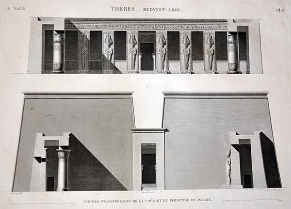
6 Front of Thebes/ Medynet-Abou
Single double Folio plate from 'Description de l'Egypte', by the French government detailing the results of the Napoleon's military and scientific expedition to Egypt (1798-1801) the first comprehensive illustrated description of ancient and modern Egypt. In 1798, Napoleon embarked on his expedition to Egypt 'opening' the enigmatic kingdom to the West. Conquering Egypt, the geographical centerpoint in the axis of trade between Europe, India and the East, was an integral part of Bonaparte's strategic plan for domination. Among the civilians accompanying him, were the leading French scholars, artists, scientists, engineers and technicians, commissioned to compile a thorough survey of every aspect of Egypt that could be used to plan the countries future . The survey was divided into the antiquities, architecture, natural history and topography of Egypt coordinated by the 'l'Institut de l'Egypte' . Following the defeat of the French army, they returned to France to edit and supervise the work's production. Begun in 1809, 'Description de l'Egypte' was finally completed in 1830. The plates from this work provided the first true glimpse and influenced how the west perceived Egypt. Published Paris: L'Imprimerie Imperiale, 1809-1813; l'Imprimerie Royale, 1817- .uncoloured £85 inc delivery official embossed mark indicating the Pancoucke edition top right
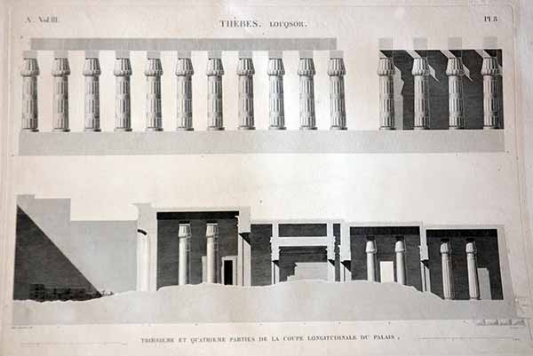
8 Side Elevation of Thebes/ Luxor
Single double Folio plate from 'Description de l'Egypte', by the French government detailing the results of the Napoleon's military and scientific expedition to Egypt (1798-1801) the first comprehensive illustrated description of ancient and modern Egypt. In 1798, Napoleon embarked on his expedition to Egypt 'opening' the enigmatic kingdom to the West. Conquering Egypt, the geographical centerpoint in the axis of trade between Europe, India and the East, was an integral part of Bonaparte's strategic plan for domination. Among the civilians accompanying him, were the leading French scholars, artists, scientists, engineers and technicians, commissioned to compile a thorough survey of every aspect of Egypt that could be used to plan the countries future . The survey was divided into the antiquities, architecture, natural history and topography of Egypt coordinated by the 'l'Institut de l'Egypte' . Following the defeat of the French army, they returned to France to edit and supervise the work's production. Begun in 1809, 'Description de l'Egypte' was finally completed in 1830. The plates from this work provided the first true glimpse and influenced how the west perceived Egypt. Published Paris: L'Imprimerie Imperiale, 1809-1813; l'Imprimerie Royale, 1817- .uncoloured £85 inc delivery official embossed mark indicating the Pancoucke edition top right
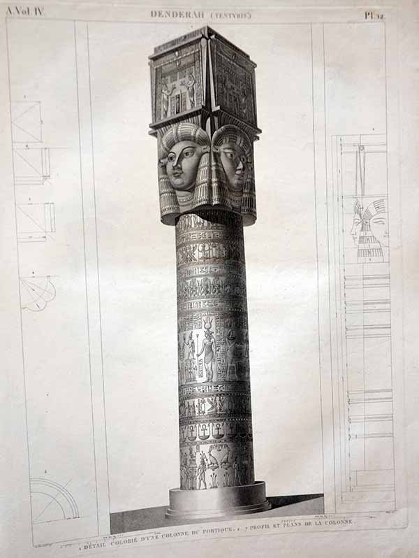
12 Column at Tentyris /Dendera
Single double Folio plate from 'Description de l'Egypte', by the French government detailing the results of the Napoleon's military and scientific expedition to Egypt (1798-1801) the first comprehensive illustrated description of ancient and modern Egypt. In 1798, Napoleon embarked on his expedition to Egypt 'opening' the enigmatic kingdom to the West. Conquering Egypt, the geographical centerpoint in the axis of trade between Europe, India and the East, was an integral part of Bonaparte's strategic plan for domination. Among the civilians accompanying him, were the leading French scholars, artists, scientists, engineers and technicians, commissioned to compile a thorough survey of every aspect of Egypt that could be used to plan the countries future . The survey was divided into the antiquities, architecture, natural history and topography of Egypt coordinated by the 'l'Institut de l'Egypte' . Following the defeat of the French army, they returned to France to edit and supervise the work's production. Begun in 1809, 'Description de l'Egypte' was finally completed in 1830. The plates from this work provided the first true glimpse and influenced how the west perceived Egypt. Published Paris: L'Imprimerie Imperiale, 1809-1813; l'Imprimerie Royale, 1817- .uncoloured £85 inc delivery No official embossed mark
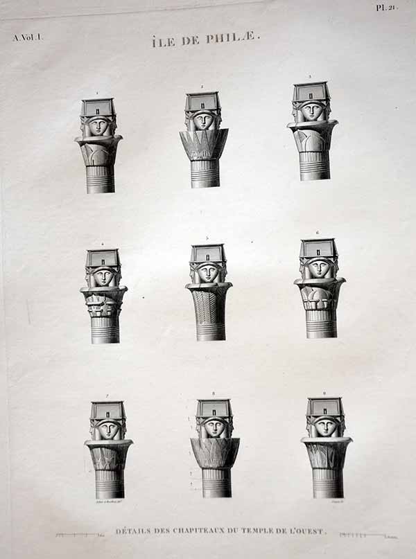
21 Capitols of columns at Philae
Single double Folio plate from 'Description de l'Egypte', by the French government detailing the results of the Napoleon's military and scientific expedition to Egypt (1798-1801) the first comprehensive illustrated description of ancient and modern Egypt. In 1798, Napoleon embarked on his expedition to Egypt 'opening' the enigmatic kingdom to the West. Conquering Egypt, the geographical centerpoint in the axis of trade between Europe, India and the East, was an integral part of Bonaparte's strategic plan for domination. Among the civilians accompanying him, were the leading French scholars, artists, scientists, engineers and technicians, commissioned to compile a thorough survey of every aspect of Egypt that could be used to plan the countries future . The survey was divided into the antiquities, architecture, natural history and topography of Egypt coordinated by the 'l'Institut de l'Egypte' . Following the defeat of the French army, they returned to France to edit and supervise the work's production. Begun in 1809, 'Description de l'Egypte' was finally completed in 1830. The plates from this work provided the first true glimpse and influenced how the west perceived Egypt. Published Paris: L'Imprimerie Imperiale, 1809-1813; l'Imprimerie Royale, 1817- .uncoloured £85 inc delivery
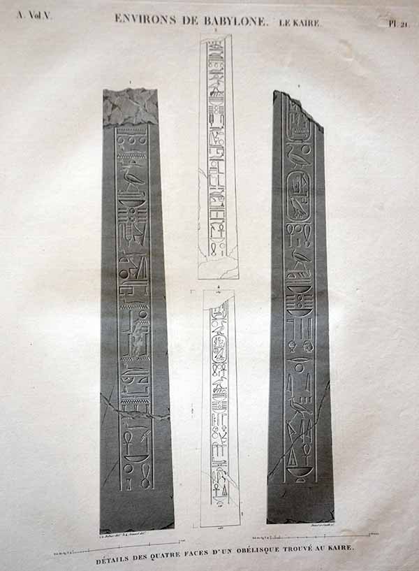
21a Stelae / Obelisk at Cairo 1
Single double Folio plate from 'Description de l'Egypte', by the French government detailing the results of the Napoleon's military and scientific expedition to Egypt (1798-1801) the first comprehensive illustrated description of ancient and modern Egypt. In 1798, Napoleon embarked on his expedition to Egypt 'opening' the enigmatic kingdom to the West. Conquering Egypt, the geographical centerpoint in the axis of trade between Europe, India and the East, was an integral part of Bonaparte's strategic plan for domination. Among the civilians accompanying him, were the leading French scholars, artists, scientists, engineers and technicians, commissioned to compile a thorough survey of every aspect of Egypt that could be used to plan the countries future . The survey was divided into the antiquities, architecture, natural history and topography of Egypt coordinated by the 'l'Institut de l'Egypte' . Following the defeat of the French army, they returned to France to edit and supervise the work's production. Begun in 1809, 'Description de l'Egypte' was finally completed in 1830. The plates from this work provided the first true glimpse and influenced how the west perceived Egypt. Published Paris: L'Imprimerie Imperiale, 1809-1813; l'Imprimerie Royale, 1817- .uncoloured £85 inc delivery official embossed mark indicating the Pancoucke edition top right
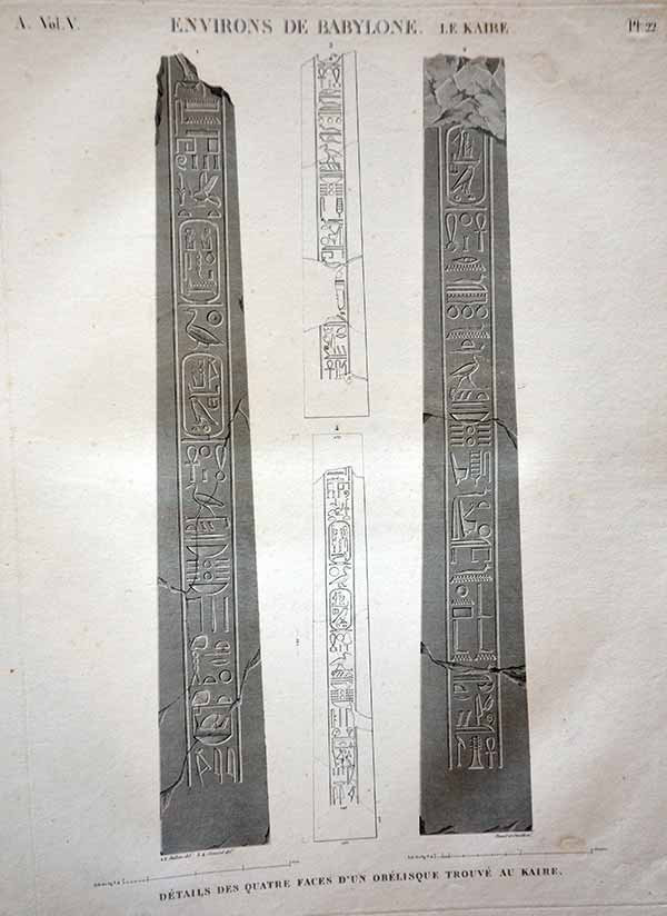
22 Stelae / Obelisk at Cairo 2
Single double Folio plate from 'Description de l'Egypte', by the French government detailing the results of the Napoleon's military and scientific expedition to Egypt (1798-1801) the first comprehensive illustrated description of ancient and modern Egypt. In 1798, Napoleon embarked on his expedition to Egypt 'opening' the enigmatic kingdom to the West. Conquering Egypt, the geographical centerpoint in the axis of trade between Europe, India and the East, was an integral part of Bonaparte's strategic plan for domination. Among the civilians accompanying him, were the leading French scholars, artists, scientists, engineers and technicians, commissioned to compile a thorough survey of every aspect of Egypt that could be used to plan the countries future . The survey was divided into the antiquities, architecture, natural history and topography of Egypt coordinated by the 'l'Institut de l'Egypte' . Following the defeat of the French army, they returned to France to edit and supervise the work's production. Begun in 1809, 'Description de l'Egypte' was finally completed in 1830. The plates from this work provided the first true glimpse and influenced how the west perceived Egypt. Published Paris: L'Imprimerie Imperiale, 1809-1813; l'Imprimerie Royale, 1817- .uncoloured £85 inc delivery official embossed mark indicating the Pancoucke edition top right

32 Thebes Carvings at memnonium
Single double Folio plate from 'Description de l'Egypte', by the French government detailing the results of the Napoleon's military and scientific expedition to Egypt (1798-1801) the first comprehensive illustrated description of ancient and modern Egypt. In 1798, Napoleon embarked on his expedition to Egypt 'opening' the enigmatic kingdom to the West. Conquering Egypt, the geographical centerpoint in the axis of trade between Europe, India and the East, was an integral part of Bonaparte's strategic plan for domination. Among the civilians accompanying him, were the leading French scholars, artists, scientists, engineers and technicians, commissioned to compile a thorough survey of every aspect of Egypt that could be used to plan the countries future . The survey was divided into the antiquities, architecture, natural history and topography of Egypt coordinated by the 'l'Institut de l'Egypte' . Following the defeat of the French army, they returned to France to edit and supervise the work's production. Begun in 1809, 'Description de l'Egypte' was finally completed in 1830. The plates from this work provided the first true glimpse and influenced how the west perceived Egypt. Published Paris: L'Imprimerie Imperiale, 1809-1813; l'Imprimerie Royale, 1817- .uncoloured £85 inc delivery official embossed mark indicating the Pancoucke edition top right

32a Elevation of Tentyris/Dendera
Single double Folio plate from 'Description de l'Egypte', by the French government detailing the results of the Napoleon's military and scientific expedition to Egypt (1798-1801) the first comprehensive illustrated description of ancient and modern Egypt. In 1798, Napoleon embarked on his expedition to Egypt 'opening' the enigmatic kingdom to the West. Conquering Egypt, the geographical centerpoint in the axis of trade between Europe, India and the East, was an integral part of Bonaparte's strategic plan for domination. Among the civilians accompanying him, were the leading French scholars, artists, scientists, engineers and technicians, commissioned to compile a thorough survey of every aspect of Egypt that could be used to plan the countries future . The survey was divided into the antiquities, architecture, natural history and topography of Egypt coordinated by the 'l'Institut de l'Egypte' . Following the defeat of the French army, they returned to France to edit and supervise the work's production. Begun in 1809, 'Description de l'Egypte' was finally completed in 1830. The plates from this work provided the first true glimpse and influenced how the west perceived Egypt. Published Paris: L'Imprimerie Imperiale, 1809-1813; l'Imprimerie Royale, 1817- .uncoloured £85 inc delivery official embossed mark indicating the Pancoucke edition top right

36 Elevation of Abydus
Single double Folio plate from 'Description de l'Egypte', by the French government detailing the results of the Napoleon's military and scientific expedition to Egypt (1798-1801) the first comprehensive illustrated description of ancient and modern Egypt. In 1798, Napoleon embarked on his expedition to Egypt 'opening' the enigmatic kingdom to the West. Conquering Egypt, the geographical centerpoint in the axis of trade between Europe, India and the East, was an integral part of Bonaparte's strategic plan for domination. Among the civilians accompanying him, were the leading French scholars, artists, scientists, engineers and technicians, commissioned to compile a thorough survey of every aspect of Egypt that could be used to plan the countries future . The survey was divided into the antiquities, architecture, natural history and topography of Egypt coordinated by the 'l'Institut de l'Egypte' . Following the defeat of the French army, they returned to France to edit and supervise the work's production. Begun in 1809, 'Description de l'Egypte' was finally completed in 1830. The plates from this work provided the first true glimpse and influenced how the west perceived Egypt. Published Paris: L'Imprimerie Imperiale, 1809-1813; l'Imprimerie Royale, 1817- .uncoloured £85 inc delivery official embossed mark indicating the Pancoucke edition top right

41 Elevation of Antaeopolis /Qaou el Kebreil
Single double Folio plate from 'Description de l'Egypte', by the French government detailing the results of the Napoleon's military and scientific expedition to Egypt (1798-1801) the first comprehensive illustrated description of ancient and modern Egypt. In 1798, Napoleon embarked on his expedition to Egypt 'opening' the enigmatic kingdom to the West. Conquering Egypt, the geographical centerpoint in the axis of trade between Europe, India and the East, was an integral part of Bonaparte's strategic plan for domination. Among the civilians accompanying him, were the leading French scholars, artists, scientists, engineers and technicians, commissioned to compile a thorough survey of every aspect of Egypt that could be used to plan the countries future . The survey was divided into the antiquities, architecture, natural history and topography of Egypt coordinated by the 'l'Institut de l'Egypte' . Following the defeat of the French army, they returned to France to edit and supervise the work's production. Begun in 1809, 'Description de l'Egypte' was finally completed in 1830. The plates from this work provided the first true glimpse and influenced how the west perceived Egypt. Published Paris: L'Imprimerie Imperiale, 1809-1813; l'Imprimerie Royale, 1817- .uncoloured £85 inc delivery official embossed mark indicating the Pancoucke edition top right

42 Elevation of Thebes /Qournah
Single double Folio plate from 'Description de l'Egypte', by the French government detailing the results of the Napoleon's military and scientific expedition to Egypt (1798-1801) the first comprehensive illustrated description of ancient and modern Egypt. In 1798, Napoleon embarked on his expedition to Egypt 'opening' the enigmatic kingdom to the West. Conquering Egypt, the geographical centerpoint in the axis of trade between Europe, India and the East, was an integral part of Bonaparte's strategic plan for domination. Among the civilians accompanying him, were the leading French scholars, artists, scientists, engineers and technicians, commissioned to compile a thorough survey of every aspect of Egypt that could be used to plan the countries future . The survey was divided into the antiquities, architecture, natural history and topography of Egypt coordinated by the 'l'Institut de l'Egypte' . Following the defeat of the French army, they returned to France to edit and supervise the work's production. Begun in 1809, 'Description de l'Egypte' was finally completed in 1830. The plates from this work provided the first true glimpse and influenced how the west perceived Egypt. Published Paris: L'Imprimerie Imperiale, 1809-1813; l'Imprimerie Royale, 1817- .uncoloured £85 inc delivery official embossed mark indicating the Pancoucke edition top right

48 Carvings from Thebes / Karnak
Single double Folio plate from 'Description de l'Egypte', by the French government detailing the results of the Napoleon's military and scientific expedition to Egypt (1798-1801) the first comprehensive illustrated description of ancient and modern Egypt. In 1798, Napoleon embarked on his expedition to Egypt 'opening' the enigmatic kingdom to the West. Conquering Egypt, the geographical centerpoint in the axis of trade between Europe, India and the East, was an integral part of Bonaparte's strategic plan for domination. Among the civilians accompanying him, were the leading French scholars, artists, scientists, engineers and technicians, commissioned to compile a thorough survey of every aspect of Egypt that could be used to plan the countries future . The survey was divided into the antiquities, architecture, natural history and topography of Egypt coordinated by the 'l'Institut de l'Egypte' . Following the defeat of the French army, they returned to France to edit and supervise the work's production. Begun in 1809, 'Description de l'Egypte' was finally completed in 1830. The plates from this work provided the first true glimpse and influenced how the west perceived Egypt. Published Paris: L'Imprimerie Imperiale, 1809-1813; l'Imprimerie Royale, 1817-uncoloured £85 inc delivery official embossed mark indicating the Pancoucke edition top right

51 Carvings from Thebes / Karnak
Single double Folio plate from 'Description de l'Egypte', by the French government detailing the results of the Napoleon's military and scientific expedition to Egypt (1798-1801) the first comprehensive illustrated description of ancient and modern Egypt. In 1798, Napoleon embarked on his expedition to Egypt 'opening' the enigmatic kingdom to the West. Conquering Egypt, the geographical centerpoint in the axis of trade between Europe, India and the East, was an integral part of Bonaparte's strategic plan for domination. Among the civilians accompanying him, were the leading French scholars, artists, scientists, engineers and technicians, commissioned to compile a thorough survey of every aspect of Egypt that could be used to plan the countries future . The survey was divided into the antiquities, architecture, natural history and topography of Egypt coordinated by the 'l'Institut de l'Egypte' . Following the defeat of the French army, they returned to France to edit and supervise the work's production. Begun in 1809, 'Description de l'Egypte' was finally completed in 1830. The plates from this work provided the first true glimpse and influenced how the west perceived Egypt. Published Paris: L'Imprimerie Imperiale, 1809-1813; l'Imprimerie Royale, 1817-uncoloured £85 inc delivery official embossed mark indicating the Pancoucke edition top right
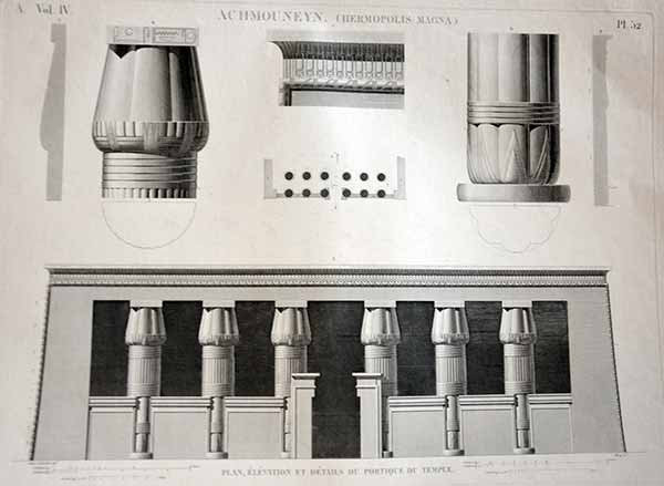
52 Elevation of Achmounen /Hermopolis
Single double Folio plate from 'Description de l'Egypte', by the French government detailing the results of the Napoleon's military and scientific expedition to Egypt (1798-1801) the first comprehensive illustrated description of ancient and modern Egypt. In 1798, Napoleon embarked on his expedition to Egypt 'opening' the enigmatic kingdom to the West. Conquering Egypt, the geographical centerpoint in the axis of trade between Europe, India and the East, was an integral part of Bonaparte's strategic plan for domination. Among the civilians accompanying him, were the leading French scholars, artists, scientists, engineers and technicians, commissioned to compile a thorough survey of every aspect of Egypt that could be used to plan the countries future . The survey was divided into the antiquities, architecture, natural history and topography of Egypt coordinated by the 'l'Institut de l'Egypte' . Following the defeat of the French army, they returned to France to edit and supervise the work's production. Begun in 1809, 'Description de l'Egypte' was finally completed in 1830. The plates from this work provided the first true glimpse and influenced how the west perceived Egypt. Published Paris: L'Imprimerie Imperiale, 1809-1813; l'Imprimerie Royale, 1817-uncoloured £85 inc delivery official embossed mark indicating the Pancoucke edition top right

53 Portico of Edfou/Apollinoplois
Single double Folio plate from 'Description de l'Egypte', by the French government detailing the results of the Napoleon's military and scientific expedition to Egypt (1798-1801) the first comprehensive illustrated description of ancient and modern Egypt. In 1798, Napoleon embarked on his expedition to Egypt 'opening' the enigmatic kingdom to the West. Conquering Egypt, the geographical centerpoint in the axis of trade between Europe, India and the East, was an integral part of Bonaparte's strategic plan for domination. Among the civilians accompanying him, were the leading French scholars, artists, scientists, engineers and technicians, commissioned to compile a thorough survey of every aspect of Egypt that could be used to plan the countries future . The survey was divided into the antiquities, architecture, natural history and topography of Egypt coordinated by the 'l'Institut de l'Egypte' . Following the defeat of the French army, they returned to France to edit and supervise the work's production. Begun in 1809, 'Description de l'Egypte' was finally completed in 1830. The plates from this work provided the first true glimpse and influenced how the west perceived Egypt. Published Paris: L'Imprimerie Imperiale, 1809-1813; l'Imprimerie Royale, 1817-uncoloured £85 inc delivery official embossed mark indicating the Pancoucke edition top right
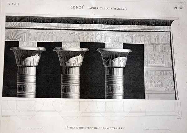
56 Portico of Edfou/Apollinoplois detail
Single double Folio plate from 'Description de l'Egypte', by the French government detailing the results of the Napoleon's military and scientific expedition to Egypt (1798-1801) the first comprehensive illustrated description of ancient and modern Egypt. In 1798, Napoleon embarked on his expedition to Egypt 'opening' the enigmatic kingdom to the West. Conquering Egypt, the geographical centerpoint in the axis of trade between Europe, India and the East, was an integral part of Bonaparte's strategic plan for domination. Among the civilians accompanying him, were the leading French scholars, artists, scientists, engineers and technicians, commissioned to compile a thorough survey of every aspect of Egypt that could be used to plan the countries future . The survey was divided into the antiquities, architecture, natural history and topography of Egypt coordinated by the 'l'Institut de l'Egypte' . Following the defeat of the French army, they returned to France to edit and supervise the work's production. Begun in 1809, 'Description de l'Egypte' was finally completed in 1830. The plates from this work provided the first true glimpse and influenced how the west perceived Egypt. Published Paris: L'Imprimerie Imperiale, 1809-1813; l'Imprimerie Royale, 1817-uncoloured £85 inc delivery official embossed mark indicating the Pancoucke edition top right

60 Antiquities in Alabaster
Single double Folio plate from 'Description de l'Egypte', by the French government detailing the results of the Napoleon's military and scientific expedition to Egypt (1798-1801) the first comprehensive illustrated description of ancient and modern Egypt. In 1798, Napoleon embarked on his expedition to Egypt 'opening' the enigmatic kingdom to the West. Conquering Egypt, the geographical centerpoint in the axis of trade between Europe, India and the East, was an integral part of Bonaparte's strategic plan for domination. Among the civilians accompanying him, were the leading French scholars, artists, scientists, engineers and technicians, commissioned to compile a thorough survey of every aspect of Egypt that could be used to plan the countries future . The survey was divided into the antiquities, architecture, natural history and topography of Egypt coordinated by the 'l'Institut de l'Egypte' . Following the defeat of the French army, they returned to France to edit and supervise the work's production. Begun in 1809, 'Description de l'Egypte' was finally completed in 1830. The plates from this work provided the first true glimpse and influenced how the west perceived Egypt. Published Paris: L'Imprimerie Imperiale, 1809-1813; l'Imprimerie Royale, 1817-uncoloured £85 inc delivery official embossed mark indicating the Pancoucke edition top right
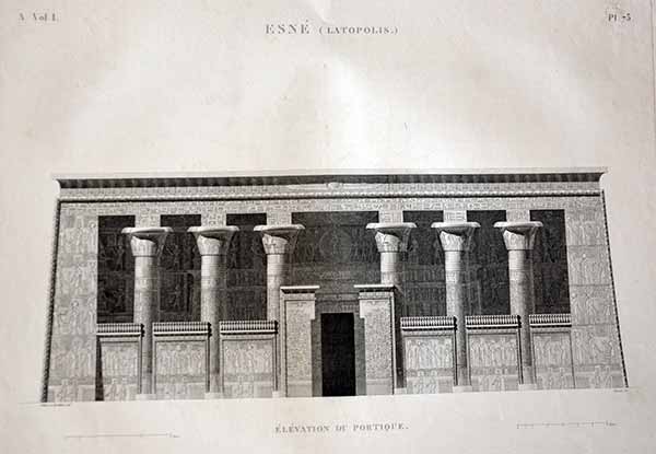
73 Elevation of Esne /Latopolis
Single double Folio plate from 'Description de l'Egypte', by the French government detailing the results of the Napoleon's military and scientific expedition to Egypt (1798-1801) the first comprehensive illustrated description of ancient and modern Egypt. In 1798, Napoleon embarked on his expedition to Egypt 'opening' the enigmatic kingdom to the West. Conquering Egypt, the geographical centerpoint in the axis of trade between Europe, India and the East, was an integral part of Bonaparte's strategic plan for domination. Among the civilians accompanying him, were the leading French scholars, artists, scientists, engineers and technicians, commissioned to compile a thorough survey of every aspect of Egypt that could be used to plan the countries future . The survey was divided into the antiquities, architecture, natural history and topography of Egypt coordinated by the 'l'Institut de l'Egypte' . Following the defeat of the French army, they returned to France to edit and supervise the work's production. Begun in 1809, 'Description de l'Egypte' was finally completed in 1830. The plates from this work provided the first true glimpse and influenced how the west perceived Egypt. Published Paris: L'Imprimerie Imperiale, 1809-1813; l'Imprimerie Royale, 1817-uncoloured £85 inc delivery official embossed mark indicating the Pancoucke edition top right

75 Capitols of columns at Esne /Latopolis
Single double Folio plate from 'Description de l'Egypte', by the French government detailing the results of the Napoleon's military and scientific expedition to Egypt (1798-1801) the first comprehensive illustrated description of ancient and modern Egypt. In 1798, Napoleon embarked on his expedition to Egypt 'opening' the enigmatic kingdom to the West. Conquering Egypt, the geographical centerpoint in the axis of trade between Europe, India and the East, was an integral part of Bonaparte's strategic plan for domination. Among the civilians accompanying him, were the leading French scholars, artists, scientists, engineers and technicians, commissioned to compile a thorough survey of every aspect of Egypt that could be used to plan the countries future . The survey was divided into the antiquities, architecture, natural history and topography of Egypt coordinated by the 'l'Institut de l'Egypte' . Following the defeat of the French army, they returned to France to edit and supervise the work's production. Begun in 1809, 'Description de l'Egypte' was finally completed in 1830. The plates from this work provided the first true glimpse and influenced how the west perceived Egypt. Published Paris: L'Imprimerie Imperiale, 1809-1813; l'Imprimerie Royale, 1817- They have the centre fold as issued and seem to have traces of a horizontal fold on some.uncoloured £85 inc delivery official embossed mark indicating the Pancoucke edition top right
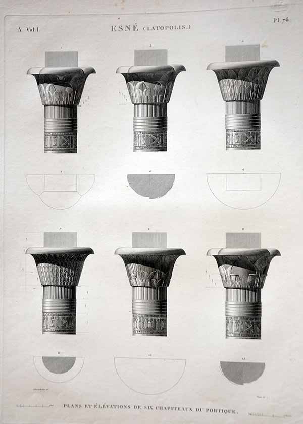
76 Capitols of columns at Esne /Latopolis 2
Single double Folio plate from 'Description de l'Egypte', by the French government detailing the results of the Napoleon's military and scientific expedition to Egypt (1798-1801) the first comprehensive illustrated description of ancient and modern Egypt. In 1798, Napoleon embarked on his expedition to Egypt 'opening' the enigmatic kingdom to the West. Conquering Egypt, the geographical centerpoint in the axis of trade between Europe, India and the East, was an integral part of Bonaparte's strategic plan for domination. Among the civilians accompanying him, were the leading French scholars, artists, scientists, engineers and technicians, commissioned to compile a thorough survey of every aspect of Egypt that could be used to plan the countries future . The survey was divided into the antiquities, architecture, natural history and topography of Egypt coordinated by the 'l'Institut de l'Egypte' . Following the defeat of the French army, they returned to France to edit and supervise the work's production. Begun in 1809, 'Description de l'Egypte' was finally completed in 1830. The plates from this work provided the first true glimpse and influenced how the west perceived Egypt. Published Paris: L'Imprimerie Imperiale, 1809-1813; l'Imprimerie Royale, 1817- They have the centre fold as issued and seem to have traces of a horizontal fold on some.uncoloured official embossed mark indicating the Pancoucke edition top right £85 inc delivery

76b carvings from Thebes / Hypogees
Single double Folio plate from 'Description de l'Egypte', by the French government detailing the results of the Napoleon's military and scientific expedition to Egypt (1798-1801) the first comprehensive illustrated description of ancient and modern Egypt. In 1798, Napoleon embarked on his expedition to Egypt 'opening' the enigmatic kingdom to the West. Conquering Egypt, the geographical centerpoint in the axis of trade between Europe, India and the East, was an integral part of Bonaparte's strategic plan for domination. Among the civilians accompanying him, were the leading French scholars, artists, scientists, engineers and technicians, commissioned to compile a thorough survey of every aspect of Egypt that could be used to plan the countries future . The survey was divided into the antiquities, architecture, natural history and topography of Egypt coordinated by the 'l'Institut de l'Egypte' . Following the defeat of the French army, they returned to France to edit and supervise the work's production. Begun in 1809, 'Description de l'Egypte' was finally completed in 1830. The plates from this work provided the first true glimpse and influenced how the west perceived Egypt. Published Paris: L'Imprimerie Imperiale, 1809-1813; l'Imprimerie Royale, 1817-uncoloured £85 inc delivery official embossed mark indicating the Pancoucke edition top right

77 Capitols of columns at Esne 3
Single double Folio plate from 'Description de l'Egypte', by the French government detailing the results of the Napoleon's military and scientific expedition to Egypt (1798-1801) the first comprehensive illustrated description of ancient and modern Egypt. In 1798, Napoleon embarked on his expedition to Egypt 'opening' the enigmatic kingdom to the West. Conquering Egypt, the geographical centerpoint in the axis of trade between Europe, India and the East, was an integral part of Bonaparte's strategic plan for domination. Among the civilians accompanying him, were the leading French scholars, artists, scientists, engineers and technicians, commissioned to compile a thorough survey of every aspect of Egypt that could be used to plan the countries future . The survey was divided into the antiquities, architecture, natural history and topography of Egypt coordinated by the 'l'Institut de l'Egypte' . Following the defeat of the French army, they returned to France to edit and supervise the work's production. Begun in 1809, 'Description de l'Egypte' was finally completed in 1830. The plates from this work provided the first true glimpse and influenced how the west perceived Egypt. Published Paris: L'Imprimerie Imperiale, 1809-1813; l'Imprimerie Royale, 1817- They have the centre fold as issued and seem to have traces of a horizontal fold on some.uncoloured official embossed mark indicating the Pancoucke edition top right £85 inc delivery

80 carvings from Thebes / Byban el Malouk
Single double Folio plate from 'Description de l'Egypte', by the French government detailing the results of the Napoleon's military and scientific expedition to Egypt (1798-1801) the first comprehensive illustrated description of ancient and modern Egypt. In 1798, Napoleon embarked on his expedition to Egypt 'opening' the enigmatic kingdom to the West. Conquering Egypt, the geographical centerpoint in the axis of trade between Europe, India and the East, was an integral part of Bonaparte's strategic plan for domination. Among the civilians accompanying him, were the leading French scholars, artists, scientists, engineers and technicians, commissioned to compile a thorough survey of every aspect of Egypt that could be used to plan the countries future . The survey was divided into the antiquities, architecture, natural history and topography of Egypt coordinated by the 'l'Institut de l'Egypte' . Following the defeat of the French army, they returned to France to edit and supervise the work's production. Begun in 1809, 'Description de l'Egypte' was finally completed in 1830. The plates from this work provided the first true glimpse and influenced how the west perceived Egypt. Published Paris: L'Imprimerie Imperiale, 1809-1813; l'Imprimerie Royale, 1817-uncoloured £85 inc delivery official embossed mark indicating the Pancoucke edition top right

81 Carvings from Thebes / Byban el Malouk 2
Single double Folio plate from 'Description de l'Egypte', by the French government detailing the results of the Napoleon's military and scientific expedition to Egypt (1798-1801) the first comprehensive illustrated description of ancient and modern Egypt. In 1798, Napoleon embarked on his expedition to Egypt 'opening' the enigmatic kingdom to the West. Conquering Egypt, the geographical centerpoint in the axis of trade between Europe, India and the East, was an integral part of Bonaparte's strategic plan for domination. Among the civilians accompanying him, were the leading French scholars, artists, scientists, engineers and technicians, commissioned to compile a thorough survey of every aspect of Egypt that could be used to plan the countries future . The survey was divided into the antiquities, architecture, natural history and topography of Egypt coordinated by the 'l'Institut de l'Egypte' . Following the defeat of the French army, they returned to France to edit and supervise the work's production. Begun in 1809, 'Description de l'Egypte' was finally completed in 1830. The plates from this work provided the first true glimpse and influenced how the west perceived Egypt. Published Paris: L'Imprimerie Imperiale, 1809-1813; l'Imprimerie Royale, 1817-uncoloured £85 inc delivery official embossed mark indicating the Pancoucke edition top right

ee Vases/Potteries pair
Single double Folio plate from 'Description de l'Egypte', by the French government detailing the results of the Napoleon's military and scientific expedition to Egypt (1798-1801) the first comprehensive illustrated description of ancient and modern Egypt. In 1798, Napoleon embarked on his expedition to Egypt 'opening' the enigmatic kingdom to the West. Conquering Egypt, the geographical centerpoint in the axis of trade between Europe, India and the East, was an integral part of Bonaparte's strategic plan for domination. Among the civilians accompanying him, were the leading French scholars, artists, scientists, engineers and technicians, commissioned to compile a thorough survey of every aspect of Egypt that could be used to plan the countries future . The survey was divided into the antiquities, architecture, natural history and topography of Egypt coordinated by the 'l'Institut de l'Egypte' . Following the defeat of the French army, they returned to France to edit and supervise the work's production. Begun in 1809, 'Description de l'Egypte' was finally completed in 1830. The plates from this work provided the first true glimpse and influenced how the west perceived Egypt. Published Paris: L'Imprimerie Imperiale, 1809-1813; l'Imprimerie Royale, 1817-uncoloured £125 PAIR inc delivery official embossed mark indicating the Pancoucke edition top right
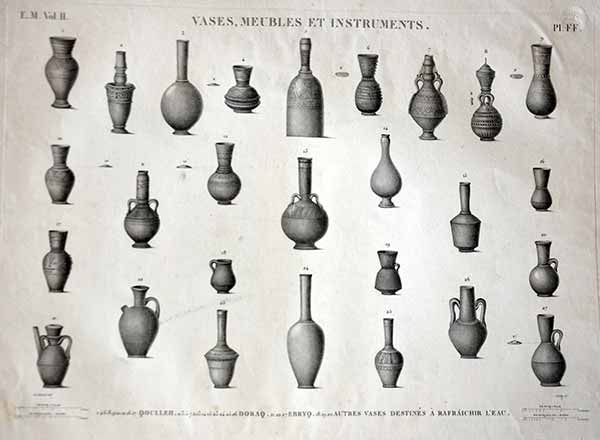
ff see above official embossed mark indicating the Pancoucke edition top right


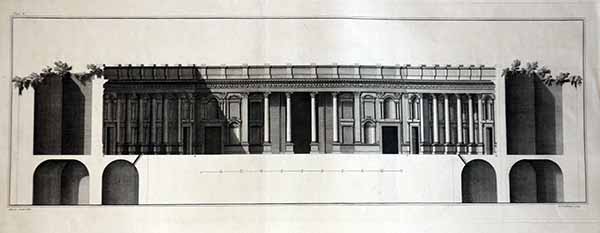
Set of four Elevations of Balbec
The Ruins of Balbec, Engraved by Paul Fourdrinier after Giovanni Battista Borra . This was by Robert Wood, "The Ruins of Balbec, otherwise Heliopolis in Coelosyria" Published in London) 1757; containing 46 plates (including a number of fold-out plates) depicting the architecture of Balbec in views, elevations, plans, diagrams, with letterpress explanation of the plates. Etching and engraving Page size Height: 545 millimetres Width: 360 millimetres but with the engravings almost letterbox style RARE £385 set FOLDED PAFE NO official embossed mark

Tombeau à Jediekombet ; Tombeau sur le Mont Piedrakoes ; Tombeau sur le Mont Piedrakoes
Copper engraving with later hand colour from Voyage par la Moscovie, en Perse et aux Indes orientales. Pl. dépl.1 en reg. p.2 : By Cornelis de Bruijn (also spelled Cornelius de Bruyn, (1652-1726/7) was a Dutch artist and traveler. From: Travels into Muscovy, Persia, and part of the East-Indies Size Sheet: 392 x 461 mm; Plate: 289 x 382 mm Published 1718 /1728 fold as issued*** edge tears ie frayed page edges** £85 inc delivery

'Village Saksawa / Rochers Singuliers / Ruines de la Ville Cohm / Ruines des Murailles de la Ville',. . . the ruins of Qom
Copper engraving with later hand colour from Voyage par la Moscovie, en Perse et aux Indes orientales. Pl. dépl.1 en reg. p.2 : By Cornelis de Bruijn (also spelled Cornelius de Bruyn, (1652-1726/7) was a Dutch artist and traveler. From: Travels into Muscovy, Persia, and part of the East-Indies Size Sheet: 392 x 461 mm; Plate: 289 x 382 mm Published 1718 fold as issued*** edge tears ie frayed page edges** £85 inc delivery

View of Samgael - View near Samgael - Sultanie - Gihara village
Copper engraving with later hand colour from . Voyage par la Moscovie, en Perse et aux Indes orientales. Pl. dépl.1 en reg. p.2 : By Cornelis de Bruijn (also spelled Cornelius de Bruyn, (1652-1726/7) was a Dutch artist and traveler From: Travels into Muscovy, Persia, and part of the East-Indies Size Sheet: 392 x 461 mm; Plate: 289 x 382 mm Published 1718 fold as issued*** edge tears ie frayed page edges** toning to central fold £85 inc delivery

Persian ladies
Copper engraving with later hand colour from . Voyage par la Moscovie, en Perse et aux Indes orientales. Pl. dépl.1 en reg. p.2 : By Cornelis de Bruijn (also spelled Cornelius de Bruyn, (1652-1726/7) was a Dutch artist and traveler From: Travels into Muscovy, Persia, and part of the East-Indies Size Sheet: 392 x 461 mm; Plate: 289 x 382 mm Published 1718 fold as issued*** edge tears ie frayed page edges** toning to central fold £75 inc delivery

Saka, charitable derviche qui porte de l'eau par la ville ... (derviscio che porta l'acqua), Tav. 26
Engraved by Gerard Scotin 1643-1715 From Paintings by Jean-Baptiste Vanmour (Van Mour), 1671-1737 Originally from "Recueil de cent estampes representant differentes nations du Levant, gravees sur les tableaux peints d'apres nature en 1707 & 1708 par l'ordre de M. de Ferriol, Ambassadeur du Roi a la Porte; et mis au jour en 1712 & 1713 par les soins de M. Le Hay."[Collection of one hundred prints representing different nations of the Levant, engraved on the paintings from life in 1707 & 1708 by order of M. de Ferriol, Ambassador of the King to the Porte; and brought to light in 1712 & 1713 by the care of M. Le Hay] Published Paris, 1714. This was later reissued by his son.. this is the original format some old tinting in a walnut frame which needs joints reglueing £125 inc delivery

The Jewish Quarter in Jerusalem
STANISLAW STACHA HALPERN (Polish/Australian Artist 1919-1969) Etching with aquatint, The Jewish Quarter in Jerusalem, signed in pencil No. 25, 11" x 7.5", sent unframed. . .frame broken with remarque to border. numbered 9/25 . . .. Stanislaw (Stacha) Halpern (1919-1969), painter, potter, printmaker and sculptor, was born on 20 October 1919 at Zolochev, Poland (now Ukraine), son of Eisig Halpern, engineer, and his wife Berta, née Gutt. In 1938 Stacha enrolled at the School of Commercial and Fine Art, L'vov. When his studies were cut short by the German invasion of Poland, he emigrated via England to Perth in 1939 and later that year travelled to Melbourne where he was employed as a fitter and turner. At the office of the government statist, Melbourne, on 28 August 1943 he married Sylvia Pauline Black, a stenographer; they were to have a daughter before being divorced. £220 inc delivery.. more well known now as a studio potter and oil painter in Oz
The Description de l'Égypte (English: Description of Egypt) was a series of publications, appearing first in 1809 and continuing until the final volume appeared in 1829, which offered a comprehensive scientific description of ancient and modern Egypt as well as its natural history. It is the collaborative work of about 160 civilian scholars and scientists, known popularly as the savants, who accompanied Napoleon's expedition to Egypt in 1798 to 1801 as part of the French Revolutionary Wars, as well as about 2000 artists and technicians, including 400 engravers, who would later compile it into a full work.The full title of the work is Description de l'Égypte, ou Recueil des observations et des recherches qui ont été faites en Égypte pendant l'expédition de l'armée française

A Draught of the Inside of the Ark, + A Draught of the Outside of the Ark Plus Solomons Temple Ramparts
anon 1721 Presumably from Edward Wells' The Historical Geography of the Old Testiment The temple was done from an etching of the famous and much-exhibited model of Solomon's Temple created during the 1600s by Rabbi Jacob Jehudah Leon, which measured 80ft Many folds some offsetting and age toning needs a good press £35 inc delivery

Costumes et portraits : Seyd Moustafa Pacha blessé à la bataille d'Aboukir
from Monuments of Egypt/ LA DESCRIPTION DE L'GYPTE Planches extraites des volumes I et II de l'Egypte moderne
by Charles-Louis Fleury Pancoucke, 1820.Drawn by Dutertre André (1753-1842) Engraved by Raphael Urbain Massard . Copper engraving from `Description de l'Egypte` the outstanding achievement resulting from Napoleon's expedition(1798-1801) printed after 20 years of work by some of France's best engravers. Size: 43 x 59cms CONDITION : still whole page but with numerous edge tears. . . shown before conservation tape is applied. £85 delivered


Plan, élévation, coupes et détails du portique du théâtre
(vol. IV pl. 56) planche dessinée par Gilbert-Joseph Gaspard de Chabrol, from Monuments of Egypt/ LA DESCRIPTION DE L'GYPTE Planches extraites des volumes I et II de l'Egypte moderne by Charles-Louis Fleury Pancoucke, 1820.. Copper engraving from `Description de l'Egypte` the outstanding achievement resulting from Napoleon's expedition(1798-1801) printed after 20 years of work by some of France's best engravers. Size: 43 x 59cms CONDITION : butchered by a moron vertical crease to left, surface soiling and some light abrasions, cut in from plate mark worth framing for an office and losing top title . £45 delivered

Syout Cyclopolis/ Plans coupes Elevation et details du Divers Hypogees
from Monuments of Egypt/ LA DESCRIPTION DE L'GYPTE Planches extraites des volumes I et II de l'Egypte moderne by Charles-Louis Fleury Pancoucke, 1820.. Copper engraving from `Description de l'Egypte` the outstanding achievement resulting from Napoleon's expedition(1798-1801) printed after 20 years of work by some of France's best engravers. Size: 43 x 59cms CONDITION : butchered by a moron vertical crease to left, surface soiling and some light creases cut in from plate mark worth framing for an office and losing top title . £65 delivered

Vue et Details de la Roue a Jantes Creuses ou Machine a Aroser
from Monuments of Egypt/ LA DESCRIPTION DE L'GYPTE Planches extraites des volumes I et II de l'Egypte moderne by Charles-Louis Fleury Pancoucke, 1820.. Copper engraving from `Description de l'Egypte` the outstanding achievement resulting from Napoleon's expedition(1798-1801) printed after 20 years of work by some of France's best engravers. Size: 43 x 59cms CONDITION : some creasing ( light) , surface soiling and edge tears and page curling shown before conservation tape . £105 delivered

Plans coupes et details de la Roue a Pots ou Machine a Aroser
from Monuments of Egypt/ LA DESCRIPTION DE L'GYPTE Planches extraites des volumes I et II de l'Egypte moderne by Charles-Louis Fleury Pancoucke, 1820.. Copper engraving from `Description de l'Egypte` the outstanding achievement resulting from Napoleon's expedition(1798-1801) printed after 20 years of work by some of France's best engravers. Size: 43 x 59cms CONDITION : some creasing ( light) , surface soiling light stain top left corner and edge tears and page curling shown before conservation tape . £105 delivered

Chapelle Sepulchrale de Moustapha III
Cochin filius dir (Charles-Nicholas Cochin, le jeune. Paris 1715 – 1790 Paris) Nee sculp ( François Denis Née (French, 1732-1817) François-Denis Née, Denis Née ) 1787. Large folio copper /wood engraving of the tomb of Mustafa stunning condition full borders no defects very detailed by a master engraver but source aas yet untraceable £145 delivered

Habillement des principaux barbaresques
Engraved by Bernard Baron, From Recueil de cent estampes representant differentes nations du Levant, gravees sur les tableaux peints d'apres nature en . . . by Jean-Baptiste Vanmour, later reprint in larger format from in Bernard Picart, . Ceremonies et Coutumes Religieuses de tous les Peuples du Monde. Volume 7 . Gravures sur cuivre de 1712 et 1713 sous la direction de Mr le Hay, par Scotin, Baron, Rochefort, Haussard, Simmonneau, etc.., d'après les dessins de l'artiste flamand Jean-Baptiste van Mour. £85 no defects good borders

View of Phyla and the Banks of the Nile above the Cataract
Aquatint by Theodoro Almucco original drawings by Charles Hayes but unreadable. from Hamilton (William). Remarks on Several Parts of Turkey. Part i, ./Egyptiaca. Fol., 1809. one of 24 plates .Printed for T. Payne Pall Mall; 215x285mm .William Richard Hamilton (1777–1859) was a British antiquarian, traveller and diplomat. He was son of Rev. Anthony Hamilton, Archdeacon of Colchester and Anne, daughter of Richard Terrick, Bishop of London.In 1799 he was appointed chief private secretary to Thomas Bruce, 7th Earl of Elgin. He was in Egypt as the English took it over from the French, and secured the Rosetta Stone. After a voyage up the Nile, he wrote a well-known work of Egyptology. From 1809 to 1822 Hamilton served as Permanent Under-Secretary for Foreign Affairs, and from 1822 to 1825 he was Minister and Envoy Plenipotentiary at the Kingdom of Naples. In 1830 he succeeded Sir Thomas Lawrence as Secretary of the Society of Dilettanti, a post which he held until his death in 1859. £325 now underwater of course.Full borders, full page edge tear now mended top edge reinforcing to plate mark as obviously overpressure exerted

Pillar of Diocletian in the Suburbs of Alexandria
Engraving by J Powell original drawings by Charles Hayes but not labelled to this one. from Hamilton (William). Remarks on Several Parts of Turkey. Part i, ./Egyptiaca. Fol., 1809. one of 24 plates .Printed for T. Payne Pall Mall; 215x285mm .William Richard Hamilton (1777–1859) was a British antiquarian, traveller and diplomat. He was son of Rev. Anthony Hamilton, Archdeacon of Colchester and Anne, daughter of Richard Terrick, Bishop of London.In 1799 he was appointed chief private secretary to Thomas Bruce, 7th Earl of Elgin. He was in Egypt as the English took it over from the French, and secured the Rosetta Stone. After a voyage up the Nile, he wrote a well-known work of Egyptology. From 1809 to 1822 Hamilton served as Permanent Under-Secretary for Foreign Affairs, and from 1822 to 1825 he was Minister and Envoy Plenipotentiary at the Kingdom of Naples. In 1830 he succeeded Sir Thomas Lawrence as Secretary of the Society of Dilettanti, a post which he held until his death in 1859. £225 has an L in script to the base of the column whether by the author or whoever is unknown Full borders, fullpage

Temple d'Apollinopolis Magna a Edfou
From Vivant DENON, Drawn by Denon engraved by Mitan ; Travels in Upper and Lower Egypt, in Company with Several Divisions of the French Army, During the Campaigns of General Bonaparte in that Country, and Published Under His Immediate Patronage. London, Longman & Rees, and Richard Phillips 1803, RARE. . .
£55 Condition pretty good one soft diagonal crease soiling to base right corner and title crease top right corner .Edfu (Arabic إدفو, atbo Coptic) (former Behdet or Edfu or Djébaou the city float Egyptian Apollinopolis Magna in Greek) is a town in Upper Egypt.

Solomon Having Built the Temple of Jerusalem Dedicates it to the Lord
Augustin. Calmet,(1672-1757, French Benedictine,French biblical scholar, a Benedictine abbot at Nancy and Sens. .. . Copper engraving. 11-1/2x17 plus title at bottom. [London: 1732].From Vol. II of An Historical, Critical, Geographical, Chronological and Etymological Dictionary of the Bible. Fine condition. . Engraving, 29 x 43cm.Also used in Illustration to Picart's Religious Rites, 1732. Judaica. The book is the1732 folio edition of Dom Augustin Calmet's Dictionnnaire Historique, ... de la Bible. Calmet (1672-1757) was a Benedictine monk, scholar, and teacher of philosophy and theology who had access to many manuscripts and books in many libraries and was able to compile the first dictionary of its kind. His work was seminal but dated. He was a pioneer in biblical study. The dictionary was written while he was Abbey of Moyenmoutier. The English title was "An Historical, Critical, Geographical, Chronological, and Etymological Dictionary of the Holy Bible ..." The book was published originally in 1725, and there were many later editions in various languages as well as books influenced by Calmet. £145

De Leger-Ordening, volgens welk de XII stammen met de Levijten, elk onder zyn Baniere en Vaderlijk Huys, haar rondsom den Tabernakel moesten nederslaan./Title: The Army Planning, under which the tribes with the Levijten XII, each under his banner and paternal Huys, the Tabernacle had its rondsom beat down. Voor meerAlso labelled Numeri hoofdstuk I en II. Large eighteenth century engraving of biblical presentation of the battles and encampment at the tabernacle Has been laid to paper many years ago age toning to the fold, small edge tears still a rare beastie and worth the frame etc £45 inc due to condition
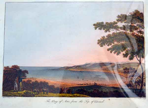
"The Bay of Acre, from the Top of Carmel"
,After Cooper Willyams (British, 1762-1816) The Reverend Cooper Willyams (1762-1816) was a topographer and artist, as well as minister and chaplain. The son of a British naval commander, he went to Cambridge, was ordained and contributed to "Topographical Miscellanies" before going to sea as Chaplain on the Boyne in 1793., Joseph Constantine Stadler (( fl London, 1780-1822). Engraver of German origin. He settled in London in the 1780s and, since he specialized in aquatint engraving, became responsible for the successful production of many ambitious topographical works. He worked closely with Joseph Farington, who made the drawings for An History of the River Thames by William Combe, published by John Boydell . For Robert Bowyer he worked on Philippe Jacques de Loutherbourg's Picturesque Scenery of Great Britain and on many publications for Rudolph Ackermann, including Views of London and Public Schools . He was still active in 1822 when he engraved the 18 plates for Thomas Rowlandson's Sketches from Nature )- Publisher - I. White, Fleet Street, London. £45
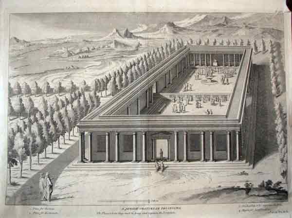
A Jewish Oratory or Proseucha. The place where they meet to pray and explain the Scripture.
Copper engraving. from Histoire de l'Ancien et du Nouveau Testament, et des Juifs, pour servir d'introduction à l'Histoire ecclesiastique de M. L'abbé Fleury. Published: 1742 by Augustin Calmet; Claude Fleury Size: 44 x 32 cm. rare large plate / fold as issued £105 inc delivery

The Egyptian Pyramids with a view of part of the Nile
Original antique ethnographic print From Thomas Bankes's A New Royal Authentic and Complete System of Universal Geography Published by Royal Authority". The print was published by C. Cooke in London ca 1775. . . . etc"" Size 12.5*x 18cms Copper engraving. : Elephant Folio. . All are as shown in the pic . £25. . . incredibly innacurate

Appearances of the Cape of Aden, St. Antony and Babel-el-Mandeb on the southern coast of Arabia Felix ; Appearances of Scotra Island to the E.N.E of Cape Guardafui on the coast of Africa / by Mr. d'Après de Mannevillette
Five profile views of the Cape of Aden, St. Antony and Babel-el-Mandeb on the southern coast of Arabia Felix and five profile views of Scotra Island to the E.N.E of Cape Guardafui on the coast of Africa.
Plate no. 10 from: The country trade East-India pilot, for the navigation of the East-Indies and oriental seas, within the limits of the East-India Company : extending from the Cape of Good Hope to China, New Holland and New Zeeland, with the Red Sea, Gulf of Persia, Bay of Bengal and China Seas / chiefly composed from actual surveys ... and from the Neptune oriental by M. d'Apres de Mannevillette. London : 10 profile views ; 45.0 x 32.4 cm. Published by Robert Sayer 1787. Jean Baptiste Nicolas Denis D' Après de Mannevillette was born in Le Havre, France and became a famous French navigator. While traveling to China he was able to correct many latitudes along the way by using new instruments. He then went on to correct maps of places such as the Red Sea, India, Indonesia, Malaya and China. All of these corrections were published Le Neptune Oriental. £280 inc delivery less collected